Posts

Showing posts from November, 2018

Pacific Northwest II; Day 13

We left Goodland, KS at 9:20 central time and it was 29 degrees under blue clear skies. We drove east on I-70 to Abilene, where we had a lunch of fried chicken plus fixins at the Brookville Hotel ( LARRAPIN GOOD FRIED CHICKEN ). We've tried eating here multiple times before but couldn't because they were closed or we didn't want to wait the necessary amount of time. Today we walked right in and had lunch. It was very good and we brought home left-over chicken for another meal. The Brookville Hotel had a small gift shop in the lobby and Chris took advantage for a few Christmas gifts. Also, while at the hotel, I used my iPhone app to increase the temperature on our home thermostat so it would be nice and toasty when we arrived. It was the first time I used it away from home - and it worked. Back on I-70 eastbound, headed for home, we were listening to the K-State football game against KU. Just as we passed the exit for Manhattan the Wildcats sealed the win but it was clos

Pacific Northwest II; Day 12

Image
It was a very relaxing morning indulging in the complimentary hotel breakfast and delaying check-out until 10:00. It was sunny and 36 degrees. Pikes Peak was looking down on us as we walked to our car in the parking lot. We drove to Garden of the Gods for a short invigorating walk. We could tell we were at altitude. We enjoyed another view of Pikes Peak behind Garden of the Gods. At 11:00 we visited with my cousin, Deb, and her husband, Jim. After lunch, some conversation and a photo op Chris and I hit the road eastbound. It was almost 3:00. We drove to Goodland, KS before we called it a night. It was 21 degrees in Goodland. Total mileage today was 194. The soak in the hotel hot tub before going to bed felt gooood. Click here to view the photos taken today:  Day12Pics

Pacific Northwest II; Day 11

Image
We started the morning in Price, UT and ended the day in Colorado Springs, CO; a 462 mile drive. It was 33 degrees when we left and it was in the 30’s when we arrived in the Springs. Our route was Hwy 6 south from Price to I-70 eastbound into Colorado. At Grand Junction we departed the interstate taking Hwy 50 eastbound. Hwy 285 took us north from Poncha Springs and at Hwy 24 we drove east to Colorado Springs. We stopped briefly at an I-70 visitor’s center in Fruita, CO. We enjoyed a lunch of Chinese food at the Panda Palace in Montrose, CO before driving on to Gunnison. Blue Mesa Reservoir was extremely low.  We gassed up the Sport in Gunnison before heading over Monarch Pass. There was quite a bit of snow at the pass but Hwy 50 was clear and dry. The mountain views from Monarch Pass to Colorado Springs are why I love driving in Colorado. Click on this link to see all the photos taken today:  Day11Pics

Pacific Northwest II; Day 10

Image
Blue clear skies all day today! It was 36 degrees when we departed but later in the morning it dropped to 30. The high temperature today was 53. We drove 456 miles from Boise to our destination in Price, UT. Interstate 84 took us south and east from Boise into Utah. I-15 took us southbound through Ogden, Salt Lake City, and numerous suburbs. At Spanish Fork we caught Hwy 6 south and east to Price. The following photo is the only one I took today. We were at a rest area on I-15 a little over 20 miles north of Ogden, UT. The mountains further south, behind Salt Lake City, are much more impressive but I did not stop on the interstate to take a photo. Instead, I found this photo online to show what they look like. We stopped in Layton, UT for lunch at the Outback Steakhouse. I was in the mood for a steak. As we were close to exiting I-15 and after we were on Hwy 6 Chris got to taking photos with her cell phone. You'll see the best of those by clicking on the link provided in

Pacific Northwest II; Day 9

Image
This day started like the last three. It was partly cloudy when we left our hotel in Gresham, OR but a short distance down Hwy 26 we were in rain again. It was 48 degrees. Hwy 26 was our route south and east in Oregon. A short jaunt on Hwy 201 took us to I-84 and southeast into Idaho to Boise (434 miles). Just south of where Hwy 26 intersected with Hwy 35 we could see the tip of Mt. Hood barely sticking out of the clouds. We were quite happy to be in sunshine and under blue skies. Further south on 26 we saw more snow capped peaks to the west. We enjoyed lunch at The Outpost in John Day, OR. Then we walked around town taking in the sights. The scenery along Hwy 26 was enjoyable. We arrived at our hotel in Boise, ID later than we would prefer. It was 6:30 and dark! Time to rest up for tomorrow. Life is good! Click on this link to see all photos taken today:  Day9Pics

Pacific Northwest II; Day 8

Image
Today was a waterfalls in the Columbia River Gorge day. On the Oregon side. I'd like to say it was a bright sunny day but it wasn't. It rained off-and-on all day. Despite the weather we saw some beautiful sights and had a great time. I-84 runs east and west through the gorge along the Columbia River. Just south of I-84 is historic Hwy 30, which once was the main highway through the gorge. So I-84 and Hwy 30 were our roads for the day. Based on some internet advice we received, we decided to visit Multnomah Falls first. We arrived there about 8:00 AM. It was raining lightly or misting during most of our time there but it was worth it. From Multnomah Falls (exit 31 on I-84) we drove back west to exit 22 and hopped on Hwy 30 eastbound. We stopped at the Women's Forum Overlook (strange name for a scenic view point) for a couple photos. In the above photo you can see a small domed building sitting on the rock outcropping. That is the Crown Point Vista House, w

Pacific Northwest II; Day 7

Image
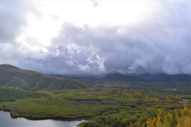
The plan for today was to drive up north and take a look at Mt. St. Helens. We did our best. We left our motel in Gresham, drove west on I-84 to I-205 northbound to I-5 northbound. At exit 49 we took off towards Mt. St. Helens on Hwy 504. As we exited I-5 it was partly sunny and we were optimistic for a view of the mountain. It became progressively more cloudy as we drove east and gained elevation. We found Mt. St. Helens encased in clouds. This was our view from the Science and Learning Center at Coldwater (the Johnston Ridge Observatory was closed for the winter). We were there about an hour and the view did not get better. Staff at the center were not optimistic about the weather improving . . . . . . so we left. On the way down we stopped to check out the sediment retention structure (dam) on Toutle Creek, which comes down from Mt. St. Helens. According to Wikipedia the dam, "is meant to prevent sediment from the 1980 eruption of Mount St. Helems from increasing flood ris

Pacific Northwest II; Day 6

Image
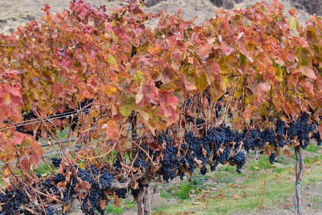
I was duly rewarded for washing the car last night. It rained as we drove south on Hwy 395 from Ritzville, WA on our way to the Columbia River, which separates Washington from Oregon. Just shy of Oregon we turned westbound on Hwy 14, which runs along the Columbia River on the Washington side. It was a great drive. The atlas had it marked as a scenic route and it definitely was. We saw vineyards and orchards. The Columbia River Gorge was beautiful and fall colors were on display. We even caught a glimpse of Mt. Hood. Now that we've driven the Washington side we plan to check out the Oregon side on day 8. In the area of Camas, WA we caught I-205 south over the Columbia River into Oregon and I-84 back east to Gresham, OR where we found our lodging for the next three nights. We drove 303 miles today. The low temperature was 45 degrees (when we started in Ritzville) and the high was 61. It rained early in the morning and was cloudy pretty much all day. Click on the

Pacific Northwest II; Day 5

We drove 455 miles today on I-90 from Bozeman, MT to Ritzville, WA. The temperature when we left was 50 and the high was 61 when we stopped. It rained off-and-on the entire route until we reached Spokane, WA. The Cracker Barrel in Missoula, MT provided our lunch and leftovers provided our evening snack in the motel. We enjoyed beautiful scenery from just west of Missoula through Idaho. There was some sort of yellow/orange colored tree mixed in with the pine trees in the mountains that was almost as pretty as changing aspens in Colorado. I did not get a photo, however, because it would not have been safe to stop on the interstate. After arriving in Ritzville I washed the car. Then we enjoyed a dip in the indoor pool and a soak in the hot tub. No photos were taken today.

Pacific Northwest II; Day 4

Image
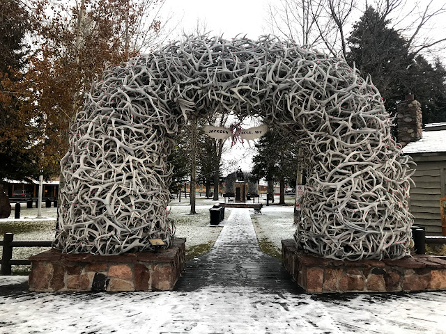
The big question today was - Will the roads in Yellowstone National Park (NP) open so we can drive through? I checked the web site when we woke up and all roads were still closed. We drove to K-Mart where Chris bought some cheap candy (post Halloween) and we also bought some cheap ponchos (because we forgot to bring some from home). Then we drove to the Jackson town square and the Jackson Hole Yellowstone Area visitor center. A guy at the visitor center verified that the roads in Yellowstone NP were closed and he doubted they would open due to the weather forecast. Chris and I drove back to the motel and checked out. We decided to drive to the south entrance to Yellowstone NP in the event they might have opened the roads. On the way we drove through Grand Teton NP but we couldn't see the mountains well due to the clouds. The entrance to Yellowstone was closed. I talked to a park ranger who couldn't say whether the park would open or not. So we started back to Jackson