Posts

Showing posts from 2014

Fall Foliage Ride II

Image
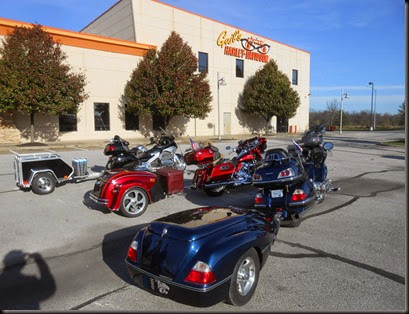
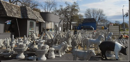
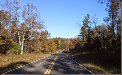
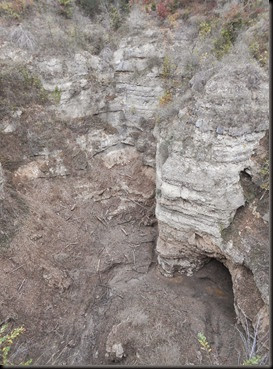
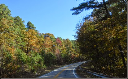
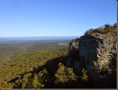
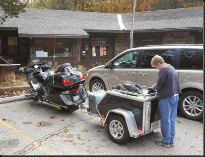
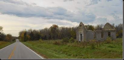
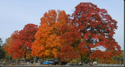
Day 1; Friday, November 7th, 2014 Chris and I left home today at 8:25. It was sunny and 45 degrees.  We rode south to Gail’s Harley Davidson in Grandview, MO, where we met up with the other folks participating in this weekend’s ride.  There was Gary (ride leader) and Bambi, Carl and Marge, Rod and Maureen, Bill and Shannon and Chris and I.. Gary, Carl and I were riding Goldwings,  Rod was riding a Harley, and Bill and Shannon were driving their Dodge Ram pickup.  When we left Gail’s it was 9:10 and 48 degrees. Our route took us east and south through Greenwood, Pleasant Hill, Holden, Chilhowee and Windsor to Cole Camp, MO, where we stopped for gas and a butt break.  We then continued east and south through Stover, Sunrise Beach, Camdenton, Lebanon, and Mansfield to Ava,MO, where we had another break.  Our very late lunch (we started eating after 4:00) was enjoyed at the Rainbow Trout Ranch in Rockbridge, MO ( http://rockbridgemo.com/ ). From Rockbridge we rode south and east to H

Fall Foliage Ride I; 11/2/14

Image
The Quality Inn we stayed at last night was quite bueno.  It was the best motel we had this trip.  If it was a flat motel it would have been perfect.  We had a nice room with a good bed and an excellent complimentary breakfast. At 9:35 we rode out of Jefferson City under cloudy skies with a temperature of 48.  Just west of Jefferson City we experienced a few rain drops but we were under blue skies in short order.   In Tipton, MO we stopped at a roadside statuary business where Chris bought a concrete angel for our landscaping. We stopped in Warrensburg and visited the University of Central Missouri campus for a short walk and a bathroom break. We rode on to Shawnee, had a late lunch, got a few groceries and then went on home.  We rode 164 miles today and our high temp was 64 – much more pleasant than yesterday. So that is THE END of this trip and I’m  looking forward to the next one in four or five days. To see pictures taken today click on the following link: https://plus.g

Fall Foliage Ride I; 11/1/14

Image
It was brrrr cold this morning – the temperature dipped below freezing during the night.  When I went out first thing in the morning there was frost on my motorcycle cover.  The temperature had skyrocketed to 37 degrees when we departed at 9:20. We rode north on Hwy 19 through Alton and Greer.  It was a pretty day and we enjoyed the scenery.  We saw two deer along this route.  One ran parallel to the road for awhile before suddenly crossing the road in front of us.  I’m glad I had slowed so there was no crisis. We were making good time until north of Eminence we came upon one of those slow-moving trailer-pulling traffic obstructions. Eventually we were able to pass and rode on to Salem, MO, where we stopped for gas and hot coffee (sugar-free cappuccino for Chris). From Salem we rode north through Rolla, Vichy, Vienna and Freeburg on our way to Jefferson City.  We checked into our motel, a Quality Inn, before having a very late lunch at Oscar’s Classic Diner ( http://oscarsclassicdi

Fall Foliage Ride I; 10/31/14

Image
We left our motel at the state line (Mammoth Springs, AR and Thayer, MO) at 9:00.  It was cloudy, 52 degrees and windy. About nine miles later we were in Grand Gulf State Park.  The park is 6 miles north and west of Thayer on County Road W where the pavement ends.  It features a collapsed cave system.  The collapse occurred about 10,000 years ago and created a vertical walled canyon about three quarters of a mile long and 130 feet deep.  It is surprising to me that the canyon floor and the lower part of the walls are completely devoid of vegetation.  Chris thinks this is possibly due to the fact that a creek drains into the canyon and rushing water may wash away vegetation.  I certainly don’t know. When we first arrived at the park we encountered a lady that we later learned was named Jackie.  She was worried because her husband, Fred, could not be found.  She did not believe he would be out walking around because of hip problems.  Chris and I set out on a search and found

Fall Foliage Ride I; 10/30/14

Image
It was 48 degrees under blue skies when we departed Russellville, AR at 8:40 – a chilly but pretty start to the day.  We rode north on Hwy 7 to Hwy 27 east and north.  Hwy 27 north of Hector, AR was beautiful – as good a ride as the Pig Trail. At one point on Hwy 27 I had the sun in my eyes and deep shadows between the road and the wooded area right of the road.  All of a sudden there was a deer hauling ass from right to left right in front of me.  I had no time to brake or react and I could not have missed the devil by more than 10 feet.  It is a good thing my bladder was empty. We stopped in Clinton for a butt break and refueling before riding on to Mammoth Springs.  Operating on a tip from Frank and Terri we had lunch at the Riverbend Restaurant on the bank of the Spring River.  It was a good tip. Today we visited Mammoth Springs State Park.  It was a very interesting park.  Mammoth Spring pumps out 9.78 million gallons of water every hour and it is the headwaters of the Spring

Fall Foliage Ride I; 10/29/14

Image
We left our motel in Clarksville and rode south and east. There was some heavy fog in the area of the Arkansas River.  It was 52 degrees. In Mt. Magazine State Park we stopped at the visitor’s center, a scenic lookout  and at the lodge for pictures. On the way out of the park a buck crossed the road in front of us.  That reminds me – yesterday on the way to Devil’s Den State Park we encountered a deer that crossed the road in front of us. We rode down the south side of the mountain and east to Russellville for lunch at Colton’s Steak House. Then we visited Mt. Nebo State Park located south and east a bit from Russellville (7 miles east of Dardanelle, in Yell County; home of Mattie Ross in the movie, True Grit).  The view from the top of Mt. Nebo was impressive. There is a hiking trail on Mt. Nebo called the Rim Trail.  It is 3.5 miles in length and advertised to take about 2 hours.  Chris and I decided to hike it.  The views from the trail were great but it was brutal in places

Fall Foliage Ride I; 10/28/14

Image
We rode south away from Siloam Springs at 8:50 under blue clear skies with a temperature of 59.  Fifty five miles later we were stopped at the visitor’s center in Devil’s Den State Park. We noticed that from Siloam Springs to the park the leaves did not appear to have changed much.  In the park, however, it was a different story.  It was purty. Also, as we rode south, we caught up with the clouds and almost caught up with the rain that went through Siloam Springs early in the morning.  Roads were wet in places in the park.  By the time we left the park the sun was peeking out again. We decided to walk the Yellow Rock Trail. ( http://www.arkansasstateparks.com/things-to-do/trails/yellow-rock-trail-171/ )  It was 40 minutes up to Yellow Rock and 30 minutes back down.  The view was great and we enjoyed the scenery and the exercise. The park also had some pretty “fire” trees ( a term coined by our grandson, Jack). From the park we rode south to Chester, AR and had lunch at the Chester

Fall Foliage Ride I; 10/27/14

Image
We left home at the butt-crack of dawn - 9:30. It was 72 degrees and sunny but the sun was very short lived. Chris and I are off on our annual fall foliage ride all by ourselves. There was a fierce wind out of the south. We rode to Olathe and hopped on Hwy 7 south to Hwy 54. From Osawatomie to Hwy 54 it is a two lane road and we enjoyed the scenery and the slower pace. Just east of Beagle, KS we stopped to get some pictures of a field full of sunflowers. North of Devon, KS there is a section of Hwy 7 that is also Hwy 31. We were riding west on this section of highway when we saw two gigantic bald eagles sitting in a plowed field. As we drew near they took flight so I had no time to stop and get a picture. We rode Hwy 54 eastbound to Hwy 43 southbound to Hwy 117 east into Webb City, MO, where we enjoyed a LARRAPIN good pork tenderloin sandwich lunch in the old downtown area. We also had salads so it was quite a healthy meal. From Webb City we took off south for Noel, MO. We’ve r

Lunch Ride to Paradise

Image
Today we rode to lunch with friends Gary, Bill and Jamie.  Our destination was Kelli’s Korner in Paradise, Missouri.  Just where is Paradise?  I checked for Paradise on Google Maps, which showed no such place.  I then checked MapQuest, however, and found it.  It is located on County Road W east of Hwy 169 by Smithville Lake.  It didn’t matter, really, because Bill & Jamie knew the way. As we rode to Bill and Jamie’s home to start our ride we noticed many beautiful fall colors in Shawnee.  We pulled into our local cemetery to get a pic of some pretty trees. After meeting up with Gary, Bill and Jamie we rode north and east to Paradise. Kelli’s Korner is a grill located in the Paradise General Store, which is a gas station, convenience store and fish tackle store. They put out some LARRAPIN good grub.  We had burgers, fries, tater tots and fried green beans.  Kelli, the proprietor, is Bill and Jamie’s daughter. As we were preparing to leave, Kelli asked if she could ride along.

CO NM UT; Day 9; September 28th, 2014

It was 63 degrees under mostly clear skies as we departed Russell, KS at 8:00.  Interstate 70 would take us all the way to the KC area.  We stopped in Salina and Topeka for gas. We stopped at Taco Bueno at the Legends in KC for lunch at about noon before riding on home.  Our route today took us 242 miles.  No pictures were taken. It was a fantastic trip; planned and led by Mel & Trisha.  They are a fun couple to travel with.  Our trip took us 2,447 miles through Kansas, Colorado, New Mexico, Arizona and Utah.

CO NM UT; Day 8; September 27th, 2014

Image
Pikes Peak was in our rear-view mirror as we left Colorado Springs at 8:00.  It was 63 degrees under blue skies.  This was the second consecutive morning that we saw a hot air balloon in the sky. We piloted the beasts east on Highways 94 and 40 to Cheyenne Wells, Colorado, where we refueled and took a butt break.  Then it was on into Kansas. The first 110 miles east of Colorado Springs were fantastic but after that a brutal wind started out of the south.  At several locations dust was blowing across the highway.  The following location was on Highway 40 west of Oakley, KS: This was on Interstate 70 east of Oakley: We refueled and ate lunch at the truck stop located just east of Oakley, at I-70 and 40 Highway.  We stopped for frozen custard at Freddy’s in Hays.  Our lodging for the night was in Russell at a Days Inn. We rode 333 miles today and the high temp was in the mid 80’s.  All the pictures I took are shown above.  If you want to see them larger, click on them. Tomorrow we

CO NM UT; Day 7; September 26th, 2014

Image
We rode away from our motel in Basalt, CO at 8:00.  The skies were clear and it was 50 degrees.  We were hunting for more aspen gold today.  Between Basalt and Aspen there was a hot air balloon in the sky. Highway 82 took us from Aspen, over Independence Pass, past the Twin Lakes area to Highway 24.  The entire route was beautiful, either from aspen gold or mountain scenery. Once on Highway 24 we headed north past Mt. Elbert (the highest peak in Colorado) to Leadville, Interstate 70,  and east to Frisco.  Highway 9 took us back south to Breckenridge, where we enjoyed a picnic lunch in a city park. We continued south through Alma, Fairplay, and Hartsel before riding east into Colorado Springs. After checking into our motel we walked across the street to the Holiday Inn and their bar & grill for dinner.  Following a couple games of golf (the card game) we called it a night. We rode 228 miles today with a low of 50 and a high of 83.  The weather was beautiful once again. For

CO NM UT; Day 6; September 25th, 2014

Image
It was 61 degrees under blue clear skies when we departed Moab at 8:30.  God blessed us with another beautiful day.  At my age any day is a blessing, but one this pretty is an extra special blessing. Just north of Moab we took Hwy 128 north and east to Cisco (a ghost town) and I-70, which we rode east to Fruita, CO.  When we stopped at a Colorado visitor’s center (to score some maps) there was a Western Slope Vietnam Veteran’s Memorial across the parking lot.  As I checked that out I thought about my favorite Vietnam veteran, Rapid Ronnie. While hanging out in the parking lot, two spandex-wearing fat guys on bicycles stopped to shoot the bull.  They highly recommended that we ride the Colorado National Monument that could be accessed just south of Fruita and terminated at Grand Junction.  We tried it and we liked it. The highest elevation on this ride was 6,640 feet.  We enjoyed a picnic lunch at the eastern end before heading into Grand Junction. We exited I-70 southbound on Hwy

CO NM UT; Day 5; September 24th, 2014

Image
We left our motel in Moab at 7:45 under blue clear skies with a crisp cool temperature of 59.  Another beautiful day. We rode 105 miles today and visited two parks. The first was Arches National Park.  We rode to the end of the park and hiked to Landscape Arch, Tunnel Arch and Pine Tree Arch.  It is a scenic park in a dry, desert rocky sort of way.  Mel hiked and climbed further than the rest of us.  He was drawn to heights us ladies were not interested in. While admiring Tunnel Arch we met two motorcycling couples from Canada.  They took our picture there. Our second park was Dead Horse Point State Park.  Dead Horse Point provided some great views of the Colorado River 2000 feet below in the Canyonlands area. Back in Moab we enjoyed a swim in the outdoor motel pool (90 degrees outside), a LARRAPIN good lasagna dinner at Pasta Jay’s (it was Lasagna Wednesday) and ice cream at the Moab Diner. For more pictures from today click on the following link: https://plus.google.com/photo