Posts

Showing posts from August, 2019

Northern Wanderings; Days 12 & 13
Image
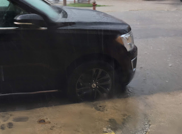
On Day 12 (8/28/19) we hung around with Deb, Tim, Myrna and their family. That evening we all celebrated Timmie's 48th birthday with some LARRAPIN good chow. We drove zero miles today. Day 13 (8/29/19) we were back on the road. After saying our goodbyes, we took off west on county road J62, north on 218, west on 2 and north on 1 to Keosauqua, IA. Chris' grandparents, on both sides of her family, are buried here and she wanted to do some cleanup on one of the headstones. It started raining well before we reached Keosauqua and it was still raining while we did our cleaning. Before leaving town we enjoyed an ice cream treat from world famous Misty's. We left Keosauqua southbound on Hwy 1, west on 2 (where the rain came down extremely hard), and south on 15 to Memphis, MO. My intention was to take 136 west all the way to Bethany but west of Lancaster, signs indicated that 136 was closed to through traffic. The detour sent us south on 63 so we decided to take 63 all the way
Northern Wanderings; Day 11

Image
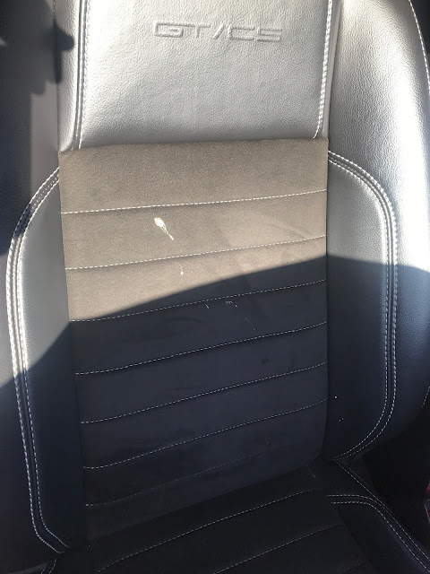
As we were loading the car this morning, the top was up and Chris just opened her car door when a bird dropped a load of crap right into the doorway onto the seat. How it missed Chris is a miracle to me. So I had to start the day cleaning bird doo off the seat and the convertible top. Our travels today started at 8:30. As we departed our hotel in Onalaska, WI it was sunny and 65 degrees. Our route was Hwy 35 south out of the Onalaska/LaCrosse area to Prairie Du Chien, where we took 27 across the Mississippi River into Iowa, 18 west, 52 south, 13 south, 30 west, I-380 south, 218 south, J-62 east to 245th Ave south, to Deb & Tim's Ranch. We arrived at 3:20 with 275 miles under our belt. The high temperature was 83 degrees with low humidity. A great day for top down cruising. Our first stop was at a roadside scenic view area on a bluff north of Genoa, WI on Hwy 35. There were some short trails to walk on and scenic views for picture taking. Mississippi River viewed fr

Northern Wanderings; Day 10

Image
It rained in the night and it was still cloudy and 63 degrees when we left our hotel in Bimidji. It rained most of the day, sometimes hard, so this is the first day of the trip with no top-down time. Our high temperature today was 76 degrees and we drove 376 miles. Our route today: 71 south out of Bemidji, 200 east (for a very short distance), 64 south to Motley, 10 south and east to Monticello, I-94 east through Minneapolis and most of St. Paul, 10 south to Prescott, WI, 35 south, and 53 south into Onalaska, WI. When we started the day we didn't think we'd have much sightseeing to do so we took pictures of roadside oddities and attractions. Here's an example in Leader, MN on Hwy 64. It seemed appropriate - a huge pig and "Clark" We stopped briefly in Motley, MN for more roadside photos and then again at Treasure City on Hwy 10 in Royalton, MN. It was time to stretch our legs and Chris wanted to explore. All sorts of treasures were waiting to be discover

Northern Wanderings; Day 9

Image
Another great day! We departed our hotel in Virginia, MN at 8:00. It was mostly cloudy and 60 degrees. Our route today was 53 south, 37 west to Hibbing, 169 west to Grand Rapids, 38 north to Effie, 1 west to Northome, and 71 south to Bemidji, where we arrived at our hotel at 4:15. The high temperature was 71 degrees. We drove 283 miles. Our first stop was at the Old Central School in Grand Rapids, MN. The building is closed on Sundays so we could not see inside so we just walked the perimeter. The school was built in 1895 and used as an elementary school until 1972. A community effort restored the building in 1984 and today it is managed by the city and used as a multi-tenant location for commerce, culture and community events (according to the City's web site). We drove the Edge of the Wilderness Scenic Byway (Hwy 38) from Grand Rapids to Effie. It was a beautiful and enjoyable drive with plenty of hills, curves and lake views. We stopped for lunch at Lazy Jack's Bar

Northern Wanderings; Day 8

Image
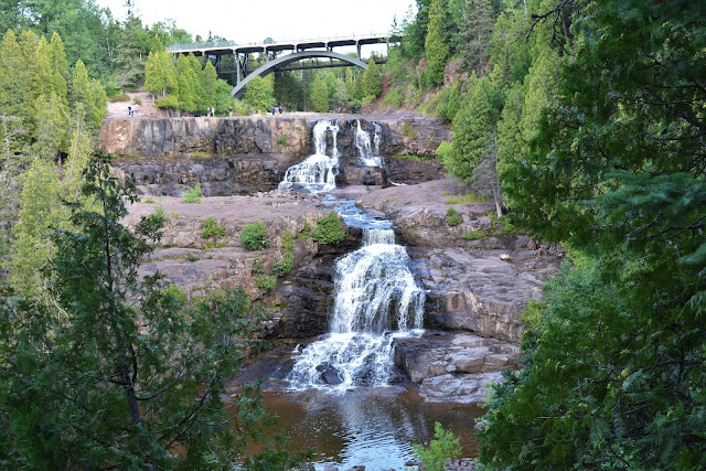
We left our hotel in Duluth, MN at 7:50 under sunny skies and it was 59 degrees. Our route today was I-35 north to 61 north along the north shore of Lake Superior. Highway 1 north and west through Ely, MN and 169 south to Virginia, where we stopped for the day. Our first stop was Gooseberry Falls State Park, a short distance north on 61. We had a great time walking and climbing around and enjoying the three big waterfalls. middle and lower falls upper falls Our next stop was Sugarloaf Cove, a bit further north along the shore of Lake Superior. Carl and Marge stopped here recently on their trip and they recommended it. It was beautiful! We did the one mile walk on the nature trail and we also walked out to the end of the peninsula that makes a cove here on the shore of Lake Superior. Chris enjoying the view at the tip of the peninsula Sugarloaf Cove We gassed up in Finland before making the drive to Ely. This route was marked as scenic on the map and I would

Northern Wanderings; Day 7

Image
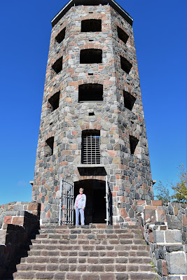
Today was a relaxing time putsing around Duluth, Minnesota. We left our hotel at 8:50. It was partly sunny and 61 degrees. Our first stop was a Great Clips so I could get my ears lowered. Stop two was at Enger Park Tower , which is located on the Skyline Scenic Byway. From here we had a great view of the Aerial Lift Bridge at Canal Park. Rotary is heavily infested in this park. There is a big Rotary Wheel in the stone walkway, Rotary memorial benches are located throughout, and the posts that hold the lights around Enger Tower are all adorned with Rotary plaques. From Enger Park we went to Canal Park where Chris did some shopping followed by lunch at Bellisio's Italian Restaurant. It was delicious and our waitress made it even more enjoyable. Chris enjoying outside seating and the meal at Belissio's Italian Restaurant After lunch we walked along Lake Superior and got a close up look at the Aerial Lift Bridge. We arrived back at our hotel a little before 2

Northern Wanderings; Day 6

Image
Our tour today started at 8:20 under sunny skies with a temperature of 56. The high temperature today was only 68! We took off southbound on 26 and turned west on 38, which took us to Ontonagon, MI on the shore of Lake Superior. When planning the route for today Google Maps revealed the fact that there was a lighthouse here. It was no easy task locating it and the shore of Lake Superior was not bueno. The very muddy Ontonagon River empties into Lake Superior nearby and that chocolate colored water was rolling onto the shore. Add to that, the lighthouse was a dinky little thing that, from a distance, looked more like a buoy of some sort. Don't bother stopping in Ontonagon, MI. Hwy 64 took us west and south to Hwy 28 west, which plopped us off in Ironwood, MI. I dropped off Chris at a Ben Franklin for some shopping while I hit a car wash to clean up Poonie (much needed). We continued westbound out of Ironwood into Wisconsin on Hwy 2 and then turned north on 13. A short dis

Northern Wanderings; Day 5

Image
Today is Grandson Ben’s 10th birthday. HAPPY BIRTHDAY to Ben! It’s hard to believe he’s ten years old. When we left our hotel in Traverse City at 8:30 it was cloudy and 69 degrees. We were headed north across the Mackinac Bridge to the Upper Peninsula of Michigan and west to Houghton, MI. Our route was Hwy 31 north, I-75 north across the bridge, 2 westbound, 77 northbound, 28 westbound at Seney, and 41 north to Houghton. There were numerous construction zones on this route but the last 15 miles or so into Houghton were painful with lengthy stops for construction zones. Our first stop of the day was at 10:30 at a park on the south end of the Mackinac Bridge, which was also the site of the Old Mackinac Point Lighthouse. I took some photos of both. We had lunch at the Tanglewood Restaurant in Shingleton, MI. We split a pasty and a salad, both of which were big so it was good we split them. The pasty was a pastry-dough pocket filled with meat (ours was chicken), vegetables, and ta

Northern Wanderings; Day 4

Image
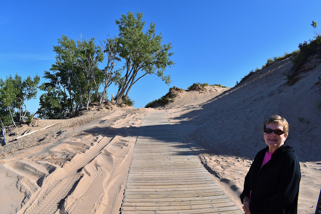
Today was a little loop drive ending back at the same hotel in Traverse City, MI. Hwy 72 took us west to the Sleeping Bear Dunes, 22 took us north to Leland, MI, which has the historic Fishtown, 22 and 201 took us north to the Grand Traverse Lighthouse, and 201 and 22 took us back south to Traverse City. Sleeping Bear Dunes: Fishtown in Leland, MI: Grand Traverse Lighthouse: We enjoyed lunch in Leland, Michigan at the Bluebird Restaurant and Tavern. Along the route today we saw pretty steel butterfly chairs, peach or apple orchards, and cherry tree orchards. It was a good day and a pretty 134 mile drive. It was sunny all day, 70 degrees when we left Traverse City, 65 degrees at Sleeping Bear Dunes, and it didn't get above 80 until we left the Grand Traverse Lighthouse. The high today was 88 degrees. We arrived back in Traverse City at 3:15. To see all the photos taken today click on this link:  Day 4 Pics