Posts

Showing posts from 2020

A December Drive

Image
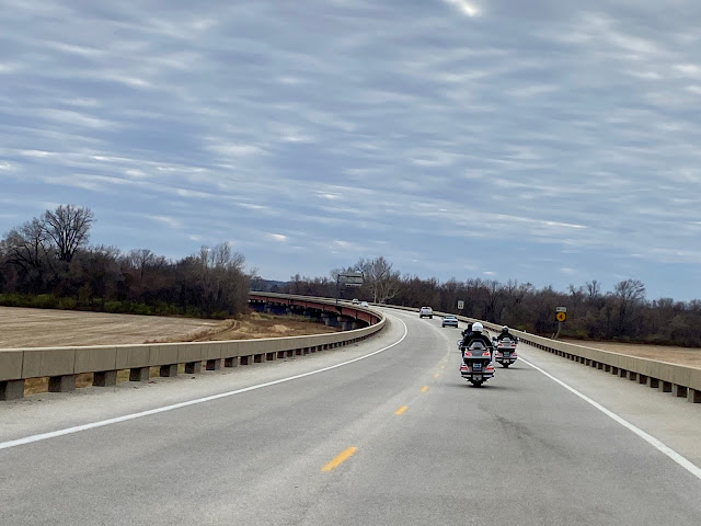
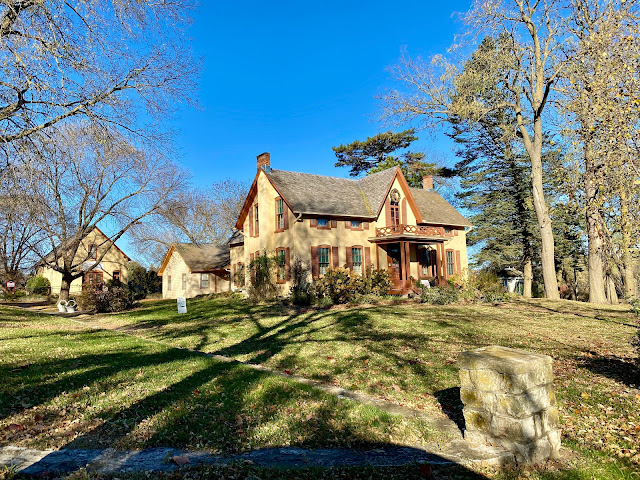
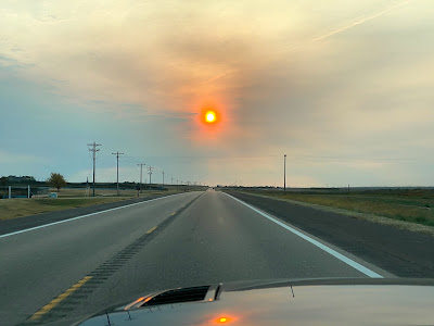
Here it was, December 10th, and the temperature was to reach the 60's.  It was a great day for a top-down drive in my Mustang convertible. I started out by driving north into Kansas City, KS, where I caught Hwy 32 westbound through Edwardsville to Bonner Springs.  Along the way I stopped to grab a photo of the historic Grinter house ( Grinter Place ), which overlooks the Kansas River valley. I left Bonner Springs driving south and west on Loring Lane and Road, stopping to take a few photos along the way. I turned south on N 158th St, which turned into Golden Road westbound, which turned into N 189th Street northbound.  Another flag barn was photographed along this route. Hwy 32 took me west through Linwood to 222nd Street southbound into Eudora, KS.  I passed a field boarded by a wooded area that looked as though it had been hit by a tornado in recent years.  Several photos were taken in and near Eudora including this stunning view of my Mustang convertible 😊. I enjoyed some fine

Topeka, BBQ & Evel Knievel

Image
 Brother Carl saw some reasonable weather days on the horizon so he took the opportunity to plan a lunch ride/drive with friends. Carl, Gary and Bill on their Goldwings and me in my Mustang were happy to participate. It had been a long time since we went on a ride together. We met at a Quik Trip in western Shawnee on Friday, November 20th, at 11:00. After some preliminary BS'ing we took off for Topeka. K-7 north to Bonner Springs, K-32 and Hwy 40 west to Lawrence, Hwy 24 west, Hwy 4 west (mostly south, actually),  and I-70 west to Topeka and Topeka Harley Davidson. At this one location there is the Harley dealership, their own small motorcycle museum, Black Dog BBQ at Henry's Grill, and the Evel Knievel Museum. When we arrived the first order of business was lunch at Black Dog BBQ, where we enjoyed average brisket sandwiches and engaging conversation - catching up and solving the world's problems. By the time we strolled around the new Harleys and the museum pieces we didn&

Lied Lodge; Day 3

Image
Today we go home. It was sunny and 37 degrees when we departed our hotel. Before leaving town (Nebraska City) we drove by the Wildwood Historic Home but it wasn't open so all we could do was snap a photo. We also visited the Missouri River Basin Lewis & Clark Center on the east end of Nebraska City, which provided a glimpse of the Missouri River. Our route today was Hwy 2 eastbound across the Missouri River into Iowa; Bluff Road (Loess Hills Scenic Byway) south to Hamburg, IA; 310th Street east; Hwy 59 south to Tarkio, MO; Hwy 136 east; Hwy or county road N south to Mound City, MO; I-29 south to the KC area. Tarkio, Missouri was the home of Tarkio College from 1883 to 1992 when it went belly-up. I attended Tarkio College my freshman year and prior to that my uncle was president of the college for awhile. The president's residence was a fine mansion at the west end of Main Street. I remember visiting this home as a child. It appears to be in good shape still today. We had a

Lied Lodge; Day 2

Image
Today was spent exploring Nebraska City, the Arbor Day Farm and the Arbor Lodge State Historic Park, which included the J. Sterling Morton mansion. We drove a whopping 23 miles. It was cloudy and 33 degrees in the morning but the clouds quickly disappeared and it warmed up to 46 degrees for a beautiful day. lunch in Nebraska City, NE downtown Nebraska City Missouri River @ Nebraska City the J. Sterling Morton mansion A statue of J. Sterling Morton with the whispering bench behind. We sat at opposite ends of the whispering bench, whispered into the back of the bench and heard it loud and clear at the other end. walking on Doug's Trail fallen leaves at the Lied Lodge To see all the photos taken today click on the following link:  Day 2 Photos

Lied Lodge; Day 1

Image
A few weeks ago Chris and I decided we wanted to spend a couple nights at the Lied Lodge and Conference Center in Nebraska City, Nebraska so we made reservations. We have never stayed here but have been wanting to give it a try. Today we took off a little before 10:00 and headed that way. It was cloudy and 37 degrees. Our route was Hwy 40 westbound from Kansas City, KS; Hwy 16 west from Tonganoxie; Hwy 59 north at Oskaloosa; Hwy 159 north at Nortonville; Hwy 73 north at Horton; Hwy 67 north just east of Verdon; Hwy 136 west at Brownville; and Hwy 75 north at Auburn to Nebraska City. As we drove into Muscotah, KS (on Hwy 159) I noticed a sign that said it was the birthplace of Joe Tinker but I couldn't read anything about who Joe Tinker was. Further into town we saw a giant baseball and Chris insisted on a photo-op. As I was taking the photo a local man stopped to shoot the bull. He informed me that Joe Tinker was of " Tinker to Evers to Chance " fame. That was the reason

Leaf Peeping II

Image
It was a beautiful fall day so Chris and I took off for Baldwin City, Kansas, home of the annual Maple Leaf Festival  to check out the fall foliage. We left shortly after 2:00 PM. Along the way we stopped at Kill Creek Park, north of DeSoto, Kansas and climbed the observation tower. Nothing noteworthy there, so no photos were taken. Upon arrival in Baldwin City we drove around town checking out the colorful trees. We also stopped at the Midland Railway Depot. Chris likes trains and old depots because her dad was a railroad man. Our last stop was Baker University, where we took a short walk around the campus. We had an enjoyable afternoon. It was sunny and 71 when we left home, the high was 72 and it was cloudy and 66 when we arrived back home at about 6:15 PM. Our top-down travels today covered a little over 100 miles. To see all the photos taken today click on this link:  PHOTOS

Leaf Peeping

Image
Last week I received a tip from a friend, Joni, that this week the changing leaves in Hiawatha, Kansas would be at their peak. Chris and I intended to check it out but our schedule got in the way. Due to morning and early evening commitments and stops along our route we ended up with too little time. We made it as far as Atchison before we headed back home. We took I-435 north out of Shawnee into Missouri and Hwy 45 north, which ends up in the Missouri River valley with bluffs to the east. We made a slow drive through part of Farley, MO and saw a tree or two. There was some color in the bluffs, but not as much as we would have liked. At Weston Bend State Park we saw some pretty fall color but the scenic view point overlooking the Missouri River was pretty much void of color. (Weston Bend State Park) At Hwy 59 we turned west and crossed the Missouri River into Atchison, KS. (as you can see, not much color along the river) In Atchison we enjoyed a lunch at Sonic before we explored the to

Colorado; Mountains & Aspens; Day 9

Image
Our last day for this trip. We left our hotel in Garden City at 8:00. It was cloudy and 46 degrees. Our route today was Hwy 50 east to Emporia and I-35 into the Kansas City area. Since there were no mountains and no aspens I decided to take a few pics as we drove east on Hwy 50 to capture the scenery of Kansas. This first photo below shows the sun trying to shine through the clouds and the second is a wind farm near Spearville, KS: Our first stop was at a rest area in Stafford County west of the town of Stafford. We gassed up and ate lunch at Newton in a truck stop restaurant called Charlie's. With a name like that I expected a fantastic dining experience - but - it was just a truck stop. We said our good-byes and took off - Mel and Trish for home - Chris and I for the Blue Valley baseball fields to see our grandson's baseball game. After leaving Newton I realized that Poonie had rolled over 80,000 miles. Time to trade her in. Our total miles today was 390 for a trip total of 1

Colorado; Mountains & Aspen; Day 8

Image
A continuation of the mouse slaying. Someone left some soapy water in the kitchen sink last night. This morning Melvin, the great white hunter, went to empty water from the sink and discovered a dead drowned mouse. Our time at the cabin in the boonies near Nathrop, CO has come to an end. We all departed at 8:55 AM. It was clear and 47 degrees. Moyer and Susan were headed east on Hwy 24 through Colorado Springs to Limon and I-70 eastbound. Mel, Trish, Chris and I took 285 south, 291 south to Salida and 50 east to Garden City, KS. Highway 50 east of Salida is a pretty drive that parallels the Arkansas River most of the way to Canon City. At one spot along Hwy 50 I saw 2 deer standing on an island in the middle of the river. Traffic and lack of a place to stop prevented getting a photo. In Canon City we drove past the Colorado Territorial Correctional Facility. It is a medium security prison and the oldest in the Colorado Department of Corrections system. It was built in 1871 as a territo

Colorado; Mountains & Aspen; Day 7

Image
One of the downsides of renting a cabin (log house) in the boonies is dealing with critters that make their way into said log house. Early on we realized we were sharing the place with mice. It became crystal clear when, on our first morning, we found they got into food left on the counter. Mel set some traps and started killing the little SOB's. Here are two found this morning. Our crew drove away from the cabin today at about 8:30 enroute to Breckenridge. Our route took us through Fairplay and Alma. Most of the aspens we saw along the way had lost their leaves but there were plenty of mountain vistas to enjoy. The photo below was taken as we drove through Alma. Breckenridge wasn't very busy so we were able to find a place to park with no problem and when we went to the pay station we found out it was free parking for the day. We visited a small museum and shopped around town a bit before having lunch at Eric's in the basement. After lunch we noticed a significant amount o

Colorado; Mountains & Aspen; Day 6

Image
 We actually set alarms this morning so we could be on the road by 8:00 AM. It wasn't quite as cold this morning (39 degrees). Our plan was to make an invasion on Aspen, CO but we knew it might be a problem due to some pre-planning with Google maps. Our departure was delayed when Mel found a low tire. Fortunately the cabin out-building had a compressor so he was able to air it back up. Highways 285 and 24 north to 82 west took us through the Twin Lakes area. We saw some pretty aspens but they were not as colorful as we've seen here before.  Some of the trees already lost their leaves. It was still worth the drive. We continued west to Independence pass. Parking was available at the pass but traffic could go no further west so Aspen was off the table. We enjoyed the views. From Independence Pass we drove back east to Twin Lakes. In the town there is a sheriff's car parked along the road with a masked up dummy in the driver's seat. It's good speed control for those wh