Posts

Showing posts from September, 2016

Montana & Canada; Day 14

Image
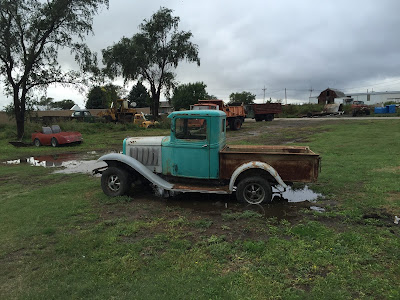
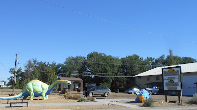
We watched Carl take off westbound at about 7:40 this morning. Chris and I did not leave until 9:10. It was 59 degrees and sunny but the sun did not last long. A short distance east the blue skies were gone. As we entered Cawker City, KS there were a bunch of old junk cars and trucks lined up in a lot at the edge of town. I had to take some pictures. And, of course, Cawker City is home to the world's largest ball of sisal twine. Next stop was Beloit, KS, a place near and dear to our near and dear neighbor, Beth. Leonardville, KS is home to Nelson's Landing, a restaurant run by family of Jordy Nelson, former K-State football player and current Green Bay Packer. It was a cool place to visit and they had LARRAPIN good food too. We stopped on the campus of Kansas State University to do some walking. It was an adventure parking in the new parking garage south of the student union. As we pulled up to grab a ticket and enter the garage a woman came running out tell

Montana & Canada; Day 13

Image
It rained quite a bit last night but this morning the sun was out and it was 54 degrees when we took off eastbound on I-80 at 8:20 (mountain time). We rode I-80 all the way to Ogallala, NE (exit 126) and went south and east through Imperial, and McCook, NE into Kansas, through Oberlin and stopped for the evening in Norton, KS at 4:45 (central time). Along the way we stopped at Happy Jack's C Store in Brule, NE (made us smile, thinking of Grandson Jack) and at Tequila's Mexican Grill in Imperial, NE for lunch. We rode 342 miles today and the Goldwing rolled over 62,000 miles. Our high temperature was 89 as we were rolling into Norton. At about 5:30 brother Carl rolled into the motel. He's headed west to the area of the Medicine Bow National Forest in south Wyoming. We enjoyed dinner and swapped some B.S. with him before calling it a night. To see the few pics taken today click on the following link: Day 13 pics

Montana & Canada; Day 12

Image
Before I get started on today, I need to provide a couple tid-bits of information that I neglected to share about yesterday. (1) We saw two deer in downtown Cody, WY. That was weird.  We saw our first antelope of this trip just north of Thermopolis. (2) When I was making reservations for last nights stay at the Elk Antler Inn in Thermopolis the lady I was talking to said she recognized the area code of my phone number as being from Kansas City. I told her I was from Shawnee, KS. She said she graduated from SMNW High School in 1975 (four years after me). It is a small world. Outside our motel this morning I saw a perfect demonstration between the difference between Harley riders and Goldwing riders. Harleys are towed and Wings are ridden. We departed Thermopolis at 8:50 this morning. We had to wait awhile for a light rain to end. After it did, the sun came out. It was 55 degrees, much better than the last couple of mornings. Highway 20 took us south and we immediately found

Montana & Canada; Day 11

Image
The weather gremlins threw another monkey wrench into our plans this morning. We planned to ride through a portion of Yellowstone National Park to check out a couple waterfalls. There was a regional winter weather advisory yesterday and last night and Yellowstone got some snow. I checked their road conditions this morning to find that several were closed, due to either snow or fire. It is good we're flexible. So our route and motel reservations had to be changed, which took some time this morning. We didn't leave until 9:30 and even then it was cloudy and 43 degrees. I-90 took us east 75 miles to exit 408 (Columbus, MT), where we took off east and south. Before entering Wyoming we stopped for lunch at the Blue Rooster Cafe in Belfry, MT. The soup and grilled ham & cheese sandwich were excellent. It was 50 degrees. We thought it was pretty cool that we crossed the Clark Fork Yellowstone River a few times. As we rode south on Highway 120 in Wyoming we could see the

Montana & Canada; Day 10

Image
Chris and I rode away from our motel at 8:45 this morning. The sun had just come out and it was 46 degrees. We didn't go far, however, because our first stop was two and a half miles away at the Montana capitol building. We walked around the grounds and took a few pictures. From the capitol we stopped at the Walmart in Helena for a little shopping and then we were off eastbound and southbound on Highways 12 and 287 towards Three Forks. At one point along this route the temperature rose to 50. We stopped to take a photo of white crosses posted along the highway. We've seen these all over the state. I did some research and found out the Montana American Legion ( white crosses ) posts and maintains them and have been doing so for 50 years ( BillingsGazette ). Two crosses represent two fatalities . We rolled into Three Forks and enjoyed some hot soup for lunch at the "3-4KS Cafe".  The Missouri Headwaters State Park is located just north and east of

Montana & Canada; Day 9

Image
We awoke this morning in our lodging at the Riverstone Family Lodge (Eureka, MT: ) to find wild turkeys in our back yard. I've never seen this many in one place. Today is the 8th birthday for our grandson, Jack.  HAPPY BIRTHDAY JACK! Back on day 6 of this trip we decided not to venture into Glacier National Park because of the weather forecast, which was cold and rain. Instead we rode north into Canada and to Banff National Park. Our plan was to hit Glacier NP today, but, again, the weather forecast scared us off. We were not anxious to experience the rain changing to snow and the sub-zero temperatures. So we took off south for Helena, MT. If you've been following this blog you'll notice that the title of this post was changed to reflect the removal of Glacier NP from our itinerary. We departed at 8:40 when it was 57 degrees. Highway 93 took us south through Eureka and Kalispell and along the way the temperature dropped briefly to 52. Highway 82 took us towards the

Glacier NP & Canada; Day 8

Image
Today was a Kootenay kind of day. We left Banff at 9:00 and it was cloudy and 55 degrees. As we rode west and north on Highway 1 the temperature dropped to 48 and then we experienced some very light and intermittent rain. This condition persisted for a while after we exited 1 onto Highway 93 that took us west and south to Eureka, MT and our lodging for the night, the Riverstone Family Lodge. Back to our Kootenay day. Highway 93 passes through the Kootenay National Park. While riding south on 93 we stopped at a rest area along a river that we found out was the Kootenay River. A pretty place it was. Highway 93 must parallel the Kootenay because as we continued southbound we crossed the Kootenay five times and when we stopped later in the day at the Wasa Rest Area we were again by the Kootenay. There was a huge organized bicycle ride on Highway 93. There were a butt-load of them riding into a fairly strong head wind. They had to be hard core. We had lunch at the

Glacier NP & Canada; Day 7

Image
Oh what a fine day we had today! We left our lodging in Banff at 9:00 and took off on the motorcycle, leaving the trailer in the motel underground parking garage. It was a brisk 43 degrees. We rode about 40 miles up the road to see Lake Louise, one of the most visited spots in Banff National Park. It was worth the ride.  The temperature had dropped to 37 by the time we arrived. There were a bunch of people here but at least we had a place to park. I was here 3 or 4 years ago with some friends on our way back from Alaska but did not get to see the lake because it was so crowded we could find no place to park. For more pictures taken here click on the following link: Lake Louise pics From Lake Louise we rode down the Bow Valley Parkway to Johnston's Canyon. A lady at Theodore Roosevelt NP told us it was a great place to visit. She was correct. A paved walking path, which included some boardwalks extending out over the canyon and Johnston's creek below, took us to

Glacier NP & Canada; Day 6

Image
The plan was to ride through Glacier National Park today and spend the night in Eureka, MT. The weather forecast for the park, however, was not good. Rain and snow in the 30's did not sound appealing and we are certainly flexible so we decided to head to Banff, AB, Canada. We departed Cut Bank, MT at 8:40 (55 degrees) and rode north about 45 miles to Canada, and they let us in with no problem. Our trip today covered 300 miles and it included about a 60 mile stretch of the worst wind we've ever experienced. It was fierce, blowing out of the west. Lunch was at Tom's House of Pizza on the outskirts of Calgary and it was a very tasty pie. Throughout the day we saw rain storms in the distance but we were dry until about 60 miles east of Banff where we rode through rain for about 5 minutes (it was 50 degrees). Our high temperature today was 61 and the low was 46. After checking into our motel in Banff we enjoyed a soak in the hot tub and then walked downtown t

Glacier NP & Canada; Day 5

Image
On this fine day we rode 337 miles from Wolf Point, MT to Cut Bank, MT on Highway 2.  Aren't those some fine names for towns?  It was raining from about 7:00 to 8:00 this morning so we delayed our departure to 9:00.  It was cloudy and 55 degrees.  The high temperature today was 72 but it was 64 when we pulled into Cut Bank.  The first 120 miles were windless but thereafter the wind was fierce.  There was a lot of standing water along our route due to recent rains. The really big news is that the Wing rolled over 60,000 miles today. We rode 115 to 120 miles before our first stop in Malta for gas and a butt break.  Also in Malta, was the Great Plains Dinosaur Museum.  We stopped to take pics on the outside but it was closed so we could not check it out. Between Glasgow and Havre   (pronounced haver)  we crossed the Milk River five times.  The countryside had been fairly flat with some rolling hills until we reached Hill County, where there were hills alongside the highway.  We w

Glacier NP & Canada; Day 4

Image
At 8:30 we were rocketing west on I-94 from Dickinson, ND.  It was 59 degrees under mostly blue clear skies.  At exit 32 we stopped at the Painted Canyon area of Theodore Roosevelt National Park and walked the nature trail.  It was a muddy mess in places due to recent rains, but we enjoyed the views and found fall foliage in display. Our next stop was the South Unit of Theodore Roosevelt National Park off I-94 exit 27 (Medora, ND).  We drove the 36 mile scenic loop and stopped at several view points for more walking and pictures. the Little Missouri River viewed from the Wind Canyon Trail Just before leaving the park we encountered a lone bison at the edge of the road. Besides the bison we saw two deer in a ravine and a butt load of prairie dogs. We hopped back on I-94 westbound and stopped at exit 1 for a late lunch at Subway.  Back on I-94 we entered Montana and continued to exit 211 where Highway 200S took us to Circle.  Highway 13 was our route north to Wolf Point, MT