Posts

Showing posts from 2019

Top Down to Council Grove

Image
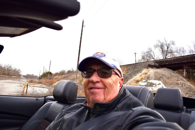
Today I drove to historic Council Grove, KS to attend a Rotary meeting. The weather was just nice enough to make it a top down trip. It was cloudy and in the mid fifties when I took off shortly after 9:00. My route was crossing the Kansas River from Shawnee into Bonner Springs and then 32 west, 24 west, 4 west (which was also I-70 west through Topeka), and 177 south to Council Grove. Along the way I stopped several times to take photos and I got gas in Eskridge. After the Rotary meeting in the basement of the Hays House Restaurant I walked around town until it started to sprinkle. The route home was 56 east, 31 east 268 east, 68 east, I-35 north, 59 north, 10 east and I-435 north to Shawnee. The top was up when I started home (due to light rain) but about 60-70 miles from home I was able to put the top down the rest of the way home. It was a good day, a 275 mile trip through the Flint Hills with a Rotary meeting in Council Grove. The high temp today was 67. To see

Home Sweet Home

Today is our Granddaughter Jenna's 14th birthday! HAPPY BIRTHDAY JENNA! Our drive home started at 8:45 when we left our hotel in Springfield, MO at 8:45 under sunny skies. It was 40 degrees. Our route was simple, Hwy 13 north to Warrensburg and Hwy 50 west to the KC area and home. In Warrensburg, MO we parked in a lot on E. Clark street at the University of Central Missouri. It was sunny and 51 degrees. During our walk around campus there were preparations underway (tailgating, gate security at the football stadium, practice field goal kicking on the field, etc.) for a football game that day. The game would be against Lincoln, which UCM would win 73-6 giving them a 10 win 0 loss record for the season. GO Mules! I bought a UCM t-shirt at the university store and then we had lunch in downtown Warrensburg at Heroes. We enjoy the food there but we especially enjoy the onion rings. True again today. At 1:45 we arrived home having driven 195 miles on the day, 3,780 miles on our e

Headed Home; Day 4

Image
It was 28 degrees when we woke up in Clarksville, Arkansas this morning. There was frost on the Poonie! It was sunny and 32 when we drove away from the hotel. The low at higher elevations was 30. High today was in the mid forties. Our route for the day was 21 north out of Clarksville (the Ozark Highlands Scenic Byway), 16 west, 23 north through Eureka Springs and Holiday Island into Missouri, 86 east, 65 north to Branson. Just north of Clarksville we had a deer run across the road about 10 yards in front of us. A reminder to keep alert. I enjoyed the route to Eureka Springs. There were plenty to hills and twisties and it was pretty in some places. Many of the trees had lost their leaves, however. We drove through a very narrow street in Eureka Springs to get a photo. We visited Holiday Island so Chris could see the condo her parents used to live in part-time. And we ate Mexican for lunch at El Mariachi in Holiday Island. In Branson we walked around The Landing area, p

Headed Home; Day 3

Image
Our day started at 7:45 driving north from Vicksburg, MS on Hwy 61 through the Mississippi Delta. It was cloudy, foggy and 61 degrees. Are there really bears in Mississippi? There were numerous signs along the highway saying #finishthepumps. I think it has something to do with prevention of floods in the area. I found two web sites that explain the situation but I couldn't make myself read all of them.      FinishThePumpsBlog       YazooBackwaterProject We turned west on Hwy 1 that turned north and paralleled the Mississippi River up to Greenville. Photos were taken of cotton bales, cotton fields, and Lake Washington. Thirty miles south of Greenville, MS we pulled over and put the top down. It was 67 degrees. I hoped the temperature would increase but they dropped instead. It was 65 degrees when we put the top back up in Greenville, MS and I was glad we did because temperatures continued to drop through the rest of the day. At Greenville, Highways 82 and 278 took us

Headed Home; Day 2

Image
When we left Eufaula, AL at 7:15 it was sunny and 57 degrees. Too cool for the top to be down. Highway 82 took us northwest to the area of Montgomery where we caught 80 west to Selma, Alabama. Selma was the site of Bloody Sunday on March 7, 1965. Blacks seeking voting rights, set out from the Brown Chapel AME Church in Selma headed for the state capitol in Montgomery. As they crossed the Alabama River on the Edmund Pettus Bridge they were attacked by police, who had been ordered by Governor Wallace to prevent the group from reaching Montgomery. Nobody was killed but many were injured. To read more you can Google "bloody sunday selma" or click on this link -  BloodySundaySelma We checked out the Civil Rights Memorial Park on the south side of the bridge. The interpretive center on the north side of the bridge. I took a picture of this large photo inside. The Brown Chapel AME (African Methodist Episcopal) Church, where the march was planned and started. A

Headed Home; Day 1

Image
Today Chris and I acknowledged 46 years and 6 months of marital bliss. Love me some Remus! I found Poonie covered with water this morning. Heavy dew, I think. At 7:45 (eastern time) we drove away from our hotel in Fort Myers, Florida. It was sunny and 73 degrees. The top was up, but just for 30 miles so the top would dry out. Our route today was simple; I-75 northbound into Georgia and Hwy 82 west at Tifton, GA. Somewhere north of the I-75 exit for Punta Gorda we stopped to put down the convertible top. It was 80 degrees and still sunny. The top was down the rest of the day. We stopped for gas at a Wawa in Wesley Chapel, Florida. Wawa is the Florida version of Quik Trip. Weird name! As you see, it was still sunny in Wesley Chapel. As we motored north on I-75 I was thinking it might get so hot and humid that we'd want to put the top back up and turn on the air conditioner. The thermometer did reach a high of 86 but it gradually became cloudy and the temps dropped as we dro

Florida; Day 5

Image
Another walk in paradise this morning. Then, after cleaning up, it was time to leave Joyce and Tom's. We took off at 9:45, headed south for Cape Coral. It was sunny and 78 degrees when we left. Two and a half hours later we arrived at Pinchers in Cape Coral. A few minutes after that our good high school friend, Rick Roseberry, arrived. We had a great visit over a tasty lunch. It had been 49 years since we last talked and there was much to catch up on. Rick cracks me up, just like he used to. After a long lunch we found a hotel in neighboring Fort Myers, Florida. We arrived at 3:30 and as we were pulling into the lot the Mustang thermometer showed it was 91 degrees. It was humid too! After a swim in the hotel pool we called it a day. We drove 150 miles today. No additional photos were taken.

Florida; Day 4

Image
Another beautiful day in Florida. When we went for our morning walk it was 66 degrees. The high temperature was 83. After our morning walk I washed Poonie and a load of clothes while Chris, Joyce and Tom went to church. I guess we know who's going to hell. Then we all went to lunch at the Rusty Pelican in Tampa. Unbeknownst to us prior to arrival, all they were offering was their Sunday brunch buffet. Great food but bad for my weight loss program. As usual, we enjoyed visiting with Joyce and Tom. After lunch we drove back into Clearwater and made a stop at a world famous landmark - the very first original Hooters, opened in 1983. I scored a shirt and a coozie. Next stop was the sponge docks in Tarpon Springs, Florida. There were numerous curio shops and opportunities to buy sponge and sponge boats were in the canal. We spent some time shopping and walking around. To see all the photos taken today click on this link:  Photos

Florida; Day 3

Image
Today was a busy day with Joyce and Tom. We started the day with a long walk around their housing complex, which is on the banks of Tampa Bay. It was cloudy and cool with a nice breeze. We saw dolphins and manatee. I did not get any photos of the dolphin. After cleaning up Tom drove us down to Clearwater Beach, where we enjoyed lunch at Frenchy's on the beach. We walked the beach and enjoyed the views. Chris did some shopping for a Clearwater Beach shot glass and then Tom drove us home. The highlight of the day was watching the K-State vs KU football game. The Cats thumped the goofy birds. We concluded the day sharing a pizza at Russo's New York Pizzeria in Clearwater. The high temperature today was in the low 80's. Poonie stayed parked all day. To see all photos taken today click on this link:  DayInPhotos

Florida; Day 2

Image
We left our hotel in Waycross, GA at 7:45. It was sunny and 43 degrees. Again today I relied on Google maps to route us to Clearwater, FL without driving on Interstate highways. It was a 273 mile drive with a high temperature of 86 degrees. We took a break and a short walk in Starke, FL and then stopped for lunch at the Monkey Bar and Grill in Homosassa, FL. There were actually monkeys on an island just out from the bar/grill. It was 73 degrees so, when we left the Monkey B&G the top came down and stayed down until we arrived at Mocassin Lake Nature Park in Clearwater, FL. We walked the nature trail and saw red tailed hawks, a bald eagle and an alligator. The birds of prey were injured and unable to survive in the wild so this place provided them a home, such as it was. It was a short drive from the nature park to Joyce and Tom's temporary home, also in Clearwater. Chris was happy to see Joyce. We took a walk around the housing complex and along the shore of Tamp

Florida; Day 1

Image
Having said our goodbyes to Ron and Cindy we rolled down the mountain near Hendersonville, NC at 7:30. It was 66 degrees and raining. Google maps were set to take us on back roads (no Interstate highways) to Clearwater, Florida. I followed Google's directions and made no attempt to record all the highways traveled. It rained all the way to Greenville, SC and most of the way it was a deluge. The highway was curvy and leaf covered, which made me anxious about the possibility of losing traction. The Poonie hung tough in the curves. It would have been a beautiful drive on a sunny day. Somewhere south of Greenville the rain stopped and in Greenwood, SC the top came down (75 degrees). It stayed down the rest of the day! Chris riding top down wearing her new do-rag We stopped briefly in Baker Creek State Park (South Carolina) so we could stretch our legs and do some walking. This park is on the banks of the Savannah River (Lake?), which is the border between South Carolina and G

North Carolina; Day 4

Image
Ron, Cindy, Chris, Charlie Another relaxing day on and around Ron & Cindy's mountain near Hendersonville, NC. We went to the Sky Top Orchard in Zirconia, NC, originally to get some apples, but in the end to get some donuts, apple butter and some other stuff. The ladies did a little shopping in Flat Rock and then again in Hendersonville. While the ladies were shopping in Flat Rock, Ron and I sat outside watching the traffic and drinking coffee and I ate a really good oatmeal raisin cookie. shopping in Flat Rock We enjoyed lunch at "A Day in the Country". I got some replacement windshield wipers for Poonie. Cindy fixed another LARRAPIN good dinner and we watched game 7 of the World Series (but maybe we went to bed before it was over???) It rained pretty much all day and it was foggy on the mountain. Temperatures were in the low 60's. Another excellent day. To see the few other photos taken today click on this link:  NCday4Pics

North Carolina; Day 3

Image
An enjoyable day was spent with Ron and Cindy. We woke up when we wanted, relaxed, napped and ate quite well. We also went to the Carl Sandburg Home National Historic Site in Flat Rock, NC where we visited the goat barn, viewed the home and walked around the lake. It was a beautiful area. Cindy and Chris eyeballing Carl Sandburg's home Ron, Chris and Cindy walking the path around the lake Cindy drove today and I have no idea how many miles it was but it wasn't much. The day started foggy (on the mountain, anyway), then turned cloudy, and later the sun peaked out a little bit. The low temperature was in the low 50's and the high in the low 60's. Supposed to rain tomorrow. To view all the photos taken today click on this link:  Day in Photos

North Carolina; Day 2

Image
Chris and I drove away (eastbound on I-40) from our hotel in Kingston Springs, TN at 8:10. It was foggy and 54 degrees. In a half hour we experienced the joy of driving through downtown Nashville. If I was smart I would have stopped on the east side of Tennessee yesterday evening. Burgess Falls State Park (southwest of Cookeville, TN) was our first stop of the day. We had a great time hiking, taking photos and just enjoying the beautiful outdoors. As you can see in the photo below there was still some fog above the river. It was lunch time when we left Burgess Falls State Park so we drove a short distance south and east on 135 and 111 to Sparta, TN, where we had some pulled pork at Jack's Top BBQ. From Sparta we drove 70 east to Crossville, where we caught I-40 eastbound. East of Knoxville we took I-26 east (going south) to Hendersonville and then back roads to Ron and Cindy's. They live in a beautiful house on top of a mountain west of Hendersonville. The view from t