Posts

Showing posts from July, 2021

Northeastern U.S.A. - Day 16

Image
Chris has an old friend, Sue, who she has not seen for around 50 years. Every time we have been in the area of Moberly, MO she mentions the fact that Sue is married and living on a farm somewhere nearby. Last night I did some internet research in an attempt to find her husband, Dale. I came up with an address about 7 miles from Moberly. We woke up this morning to cloudy skies. Before we left a storm rolled through with heavy rain and lightning. It rained or sprinkled off-and-on for the rest of the day. This pic was taken looking out our hotel window. Great scenery, huh? At 8:30 we left to find Dale and Sue's farm. As we drove by the farmstead Chris decided she wanted to knock on the door and find out if Sue was there. She was and Chris enjoyed a brief reunion. Dale and Sue were both very nice and hospitable. Below is a grainy photo of Chris and Sue taken about 50 years ago followed by a photo taken today. We returned to Moberly and stopped at a Caseys for a snack and beverage befor

Northeastern U.S.A. - Day 15

Image
Carl and Marge decided that today they would ride all the way home via I-70. Chris and I wanted another day of back road travels so we parted company. We left our hotel at 7:50 AM under sunny skies with a temperature of 70. The top was down. Our route took us north out of Effingham, IL on Highway 33. This gem was sitting by the road in Beecher City, IL. Then it was 128 north. At Cowden, IL we saw a sign for the Thompson Mill Covered Bridge. After much driving on bumpy back roads, some with gravel, we finally found it. The bridge was not well maintained and the entrance was blocked with plastic barricade fence. Our route from Cowden was 128 north; 16 west to Pana; 29 north and west; County 12 west; County 1 north; County 10 west through Morrisonville; Black Diamond Trail north; Mine Avenue west through Farmersville to Girard, IL and then Sunset Lake on Emmerson Airline (a road). At Sunset Lake we checked out the former Ewing residence. We continued west on Emmerson Airline to Palmyra an

Northeastern U.S.A. - Day 14

Image
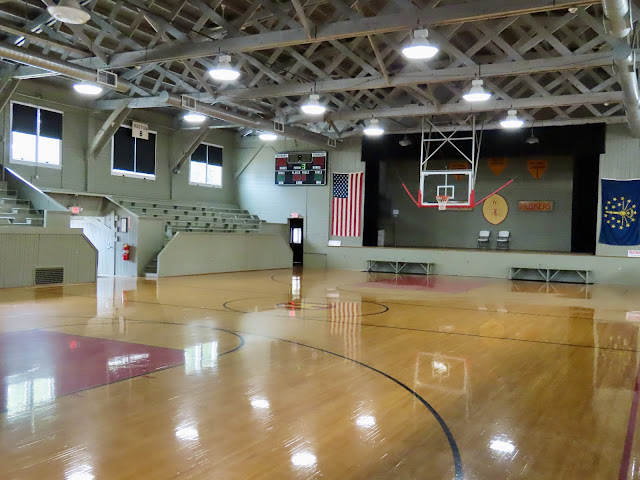
Another 8:00 AM start today under cloudy skies with a temperature of 73. Rain looked imminent. As we departed the area of Monroe, OH I lost track of the highway I was to be on so I set the GPS for Liberty, IN. From Liberty we traveled 44 west to Connersville, 1 north to Cambridge City and 40 west to Knightstown, Indiana. Knightstown is home to the Hoosier Gym, the place where home Hickory games were filmed in the movie, "Hoosiers". We were provided a very informative and interesting tour. While waiting for the gym to open we explored Knightstown and enjoyed lunch at a Mexican restaurant. So our visit to Knightstown lasted well over 2 hours, much longer than planned. There was a large mural, a scene from the movie "Hoosiers", painted on a building downtown. We continued west on 40 to Greenfield, where we jogged north to I-70 westbound; I-465 south and west around Indianapolis; back on I-70 west into Illinois to Effingham, where we stopped for the day at 3:40. We trav

Northeastern U.S.A. - Day 13

Image
The day's travels started at 8:00 AM under sunny skies with a temperature of 68 degrees. Our route today was I-76 west from Wadsworth, OH; 57 south; 585 southwest to Wooster, OH; 3 south to Mt. Vernon where we put the top down at a red light; 13 south; 661 south; 16 west; 310 south; I-70 west; 256 south to Pickerington, OH; from the Pickerington area we had the GPS lead us (on back roads) to our hotel in Middletown/Franklin, OH. In Pickerington we visited the American Motorcyclists Association Hall of Fame. After the museum (which was not air conditioned!) we drove a short distance to O'Charley's Kitchen and Bar for lunch. Good eats but they misspelled Charlie. Shortly after lunch the Tamale rolled over 10,000 miles. Carl stopped for a break at a small park that had a waterfall. How fortuitous! After settling into our hotel we left to visit Aunt Joann, cousin Wayne, his wife Susan and their family where we enjoyed a great meal and conversation. Our travels today covered 228

Northeastern U.S.A. - Day 12

Image
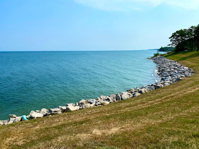
Our group took off from Jamestown, NY at 8:00 AM under blue clear sunny skies with a temperature of 63. Our route was I-86 west into Pennsylvania; I-90 west; 98 north at exit 16; 5 west; 20 west to Conneaut, OH; 531 west to Geneva by the Lake, OH; 20 west; 528 south; I-90 west; I-271 south; 8 south to Cuyahoga Valley National Park and Brandywine Falls; back roads into Hudson, OH for lunch; 303 west; 8 south; 77 south; 277 west; I-76 west to Wadsworth, OH, where we stopped for the day at 3:15. We drove 202 miles today and our high temperature was a steamy 90 degrees. Part of our route paralleled the shore of Lake Erie. In Geneva on the Lake (Ohio) we stopped at a small park for my only photo of Lake Erie. In Cuyahoga Valley National Park (just south of the Cleveland area) we viewed Brandywine Falls. It was very pretty but after seeing Niagara Falls yesterday it wasn't all that impressive. Gary and Denah were leading today so they picked our lunch spot in Hudson, OH. Gary and Denah h

Northeastern U.S.A. - Day 11

Image
Departure from Oswego, NY was at 8:00 under sunny skies with a temperature of 70. The route for today was 104 west; 14 north to Sodus Point; Lake Road west; a county road south back to 104 westbound; interstate highways around Rochester; Lake Ontario State Parkway westbound; 18 westbound; Niagara Scenic Parkway southbound to Niagara Falls; Interstates around and through Buffalo, NY south to Hwy 60 south to Jamestown, NY. We enjoyed the Sodus Point Lighthouse even though the visitor center was closed. The grounds were very nice. We found the Braddock Point Lighthouse but it was part of a private residence behind a fence. A kind neighbor showed us a public path to Lake Ontario that gave us a good view of the lighthouse. We arrived in Niagara Falls, NY at about 12:45 and we were hungry so we had lunch at the Hard Rock Cafe across from Niagara Falls State Park. It rained while we were eating and, fortunately, it stopped before we visited the park. While seated in the restaurant I noticed t

Northeastern U.S.A. - Day 10

Image
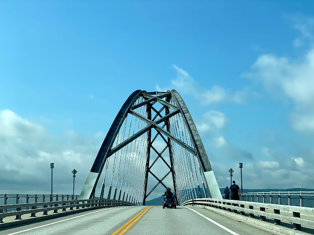
It was raining when we woke up this morning and it delayed our start to 9:00 AM. The temperature was a cool 63 so the top stayed up. Later in the day we decided to keep the top up for protection from the sun. We took some back roads from Montpelier to Middlesex where we hopped on 100B southwest, to 17 west to Chimney Point, VT, where we crossed the Lake Champlain Bridge into New York. On the New York side we stopped at the Lake Champlain visitor center, which was closed, maybe because it was Sunday. Chris and I walked to the center of the bridge to get some photos of the lake and the Champlain Memorial Lighthouse. From Port Henry, NY Hwy 9N took us north and west to Keene, where we caught Hwy 73 west to Lake Placid. Our intention was to spend some time in Lake Placid, which had been the site of the 1980 Winter Olympics. From Keene to Lake Placid and beyond, however, there was an Ironman competition in progress. We figured crowds would be a problem and we knew traffic was a problem so w

Northeastern U.S.A. - Day 9

Image
It was a highway 2 day, all the way from Bangor, ME through New Hampshire to Montpelier, Vermont. Before leaving Bangor we stopped at Stephen King's house for a photo op. It was a pretty drive but slow. The maximum speed limit today was 55 but much of it was 50 or less. We stopped in Bethel, ME for lunch. In St. Johnsbury, VT we stopped for some local maple syrup. Before calling it a day we stopped at the Vermont state capitol building for a few photos. Our route today covered 247 miles. We saw a boat load of motorcyclists out enjoying the great weather. The high temperature was 83 degrees and you can see in the photos that we had blue clear skies. To see all the photos taken today click here:  Day 9 Pics

Northeastern U.S.A. - Day 8

Image
Today was brother Carl's birthday. HAPPY BIRTHDAY to RB! Another 8:00 AM departure this morning under sunny skies with a very cool 59 degrees. Our route today was I-395, 1A, 1 and 3 to Acadia National Park and then back to our hotel in Bangor. It was a beautiful day for a tour of the park. We traveled 131 miles today and our high temperature was 80 degrees. Chris and I snuck in a little nap before we walked next door to the Ground Round for dinner.  To see all the photos taken today click on the following link:  Day 8 Pics