Posts

Showing posts from January, 2020

Break from Winter; Day 6; El Paso to Sierra Vista

Image
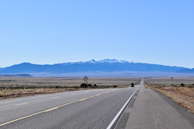
Another beautiful day! When we left El Paso at 7:45 it was sunny and 39 degrees. Our route today was 9 west, 80 west, 191 north at Douglas, West Davis Rd west at McNeal, 80 west to Tombstone. East Charleston Rd took us west and south to Sierra Vista, AZ. Hwy 9 west out of El Paso, TX parallels the border with Mexico. At times the border is a short distance away. I was excited to be able to view the border wall in places. It was still under construction and probably will be for some time. a gap in the wall can be seen here a closeup of the border wall taken with a telephoto lens from Hwy 9 There was a significant Border Patrol presence along Hwy 9. We saw numerous marked Border Patrol  vehicles, some pulling trailers with ATV's on board and one pulling a horse trailer with a horse on board. In two different locations we saw obvious surveillance vehicles set up with cameras atop elevated poles or platforms. The cameras appeared to be pivoting back and forth, scanning th

Break from Winter; Day 5; Alamogordo to El Paso

Image
We departed our hotel in Alamogordo at 8:30. It was sunny and 40 degrees. Our first stop was on the west side of town to wash the very dirty Poonie. Then we were off again, westbound on Hwy 70. Our route today was 70 west and south to the Las Cruces area, and I-25 south to El Paso, where we stopped for the day. Near Organ, NM, on Hwy 70, we drove south to the Dripping Springs Natural Area, located in the Organ Mountains - Desert Peaks Natural Area. We walked 3 miles plus (roundtrip) to Dripping Springs, the old Van Patten Mountain Camp and the old Boyd's Sanitorium. We had a great time and it was a beautiful area. From Dripping Springs we drove south to the historic Mesilla square area of Las Cruces and had a tasty lunch at La Posta, a Mexican restaurant. We walked around the square, took a couple photos and took off for El Paso, TX, arriving at our hotel at 3:30. I think it reached 61 today but it was 59 when we arrived at the hotel. We drove 115 miles

Break from Winter; Day 4; Santa Fe to Alamogordo

Image
We departed Mike & Pat's home in Santa Fe at 8:30. It was sunny and 31 degrees. Our route today was 285 south to Encino, 3 south to Duran, 54 south to Alamogordo and White Sands National Monument. North of Carrizozo, NM the Capitan Mountains appeared on the horizon. Just north of Alamogordo we stopped at McGinn's Pistachio Tree Ranch and scored some LARRAPIN good pistachios. Upon arrival in Alamogordo we ate lunch at Chili's before checking into our hotel at 1:45.  After setting up house we took off for White Sands National Monument and Park. It was in the high fifties when we entered the park. We enjoyed exploring the park. I was worried when halfway into the park a sign said the pavement ended but it ended up being tightly packed sand and it was all good. We arrived back at our hotel at 5:45 and it was 47 degrees. We drove 260 miles today. To see all the photos taken today click on the following link:  Day 4 Pics

Break from Winter; Day 3; Santa Fe

Image
Today was spent enjoying our cousins. After morning coffee with Mike and Pat we converged on the nearby Cafe Fina for a late breakfast. Mike returned to the house for some painting while the rest of us (Pat, Suzie, Jane, Chris and I) went to the Galisteo Basin Preserve for a hike, over 4 miles! the cousins: Pat, Charlie, Jane, Suzie Suzie hiking the Galisteo Basin Preserve Later in the day we all met at the Teseque Village Market for a LARRAPIN good "lupper" (between lunch and supper). Pat and Suzie then gave us a tour of old downtown Santa Fe. We concluded the day at Pat's house watching old videos of family events. It was a very enjoyable day! Poonie did not hit the highway at all. To see all the photos taken today click on the following link:  Day 3 Pics

Break from Winter; Day 2; Hugoton to Santa Fe

Image
It was a late start today, departing Hugoton at 9:30. It was sunny and 32 degrees. Our route was 56 south and west to Boise City, OK, where we took 325 west then north then west again to the Black Mesa Nature Reserve. Then 325 west into New Mexico, 406 south, 56 west and I-25 south to Santa Fe. The highest point in Oklahoma is located on the Black Mesa Nature Preserve and you can hike to a monument at that point. The map at the trailhead, however, looked like it would be 4 miles or so to the monument. Which, of course, would mean 4 miles back to the car. We hiked only 1 mile in and turned around. It was good to stretch our legs and get a little exercise. We saw a lot of cacti along the way. On I-25 between Springer, NM and Las Vegas, NM we saw several large herds of prong horn antelope. I'm confident we saw 100 or more. No photos were taken because we were trucking down I-25. We arrived at Cousin Pat's (and Mike's) house at 3:45. Snow was on the ground a

Break from Winter; Day 1

Image
Today we took off southbound in search of warmer weather. It has been brrr cold at home recently. At 8:10 we left home and drove I-35 south to the Eldorado exit off the Turnpike. From there our route was 254 west, I-235 west and south around Wichita, 54 west through Kingman, Pratt and Greensburg, 160 west, 83 south, and 51 west to Hugoton, Kansas, our destination for the day. Along the way we stopped in Kingman. A new friend and fellow Rotary club member, Kathy Peterson, hails from Kingman. She purchased an old downtown building at 214 N Main and was rehabbing it. I took some photos of it and other sites in Kingman. 214 N Main Chris in front of the old Kingman, KS Railroad Depot To see all the photos taken in Kingman click on this link:  Kingman, KS After checking into our hotel in Hugoton, KS we met with some Schechter relatives, who live in Hugoton. Cousin Tom Schechter and his wife, Karen, invited us to their home. Cousin Hal Schechter and his wife, Brenda, came o