Posts

Showing posts from October, 2021

Boys Fall Ride; Day 3

Image
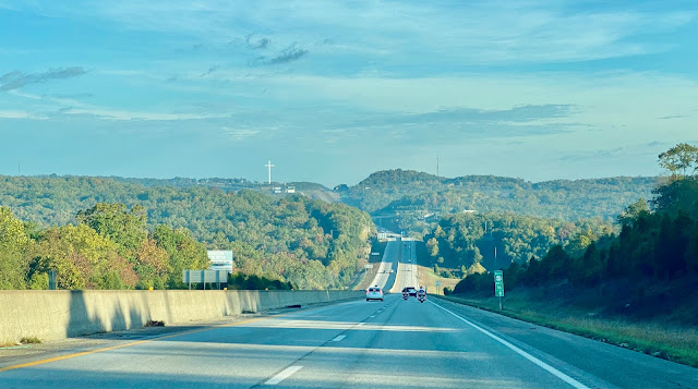
At 6:30AM it was 70 degrees in Harrison, AR. Still 70 at 8:05, we departed our hotel westbound on Hwy 412/62. Our route today was 412/62 west; 65 north to Springfield, MO; I-44 west; 13 north to Clinton; 7 northwest to Harrisonville; I-49 north to Kansas City; I-435 west; 69 north; I-35 north to Shawnee. Traveling north on 65 in the area of Branson there was a sudden drop in temperature and the highway was wet in places. In the valleys the temperature dropped as low as 58 and on top of hills the temperature was in the low 60's. We stopped for gas at a Casey's just south of Springfield. On Hwy 13, 93 miles from home we stopped so I could put the top up on my car because it looked like we'd be getting into some rain. We eventually did. I arrived home at 12:15 where it was 67 degrees. We drove 245 miles. High temperature was in the low 70's. Click here to see the four photos taken today -  day 3 pics

Boy's Fall Ride; Day 2

Image
The day started at 8:20AM when we departed the hotel in Fort Smith, AR. It was 58 degrees under blue clear skies. I put the top down and it would stay down all day - SWEET! Highway 71 took us south out of Fort Smith and we caught Highway 10 eastbound. In Magazine, AR the road was blocked for a parade so we had about a 30 minute wait. I noticed a float carrying the Magazine High School class of 71, my graduation year. After the parade, and further east on Highway 10, we passed Magazine Mountain, the highest point in Arkansas. In this photo you can see the Lodge at Magazine Mountain on the crest of the mountain (hill?). We did not venture into Magazine Mountain State Park. At Danville, AR we turned south on Highway 27, which took us to Highway 270 east, which took us into Hot Springs, AR. For lunch we enjoyed brisket sandwiches at Stubby's BBQ in Hot Springs. Then it was Highway 7 northbound nonstop all the way to Harrison, AR, where we stopped for the day. There were a few places al

Boys Fall Ride; Day 1

Image
This trip was planned sort of spur-of-the-moment by Gary and Bill. I was fortunate in that they invited me along. My brother, Carl, was also invited but he had family obligations this weekend. Leaving home at 7:20AM it was a chilly 42. We met at the QT located at 151st Street and 69 Highway at 8:00AM. At about 8:15 we departed southbound on 69 Hwy and exited at 247th Street eastbound - which took us to Cleveland, MO. From there we took back roads to Archie, MO for breakfast at Mama's Kitchen. We left Archie southbound on I-49 at about 10:30 and it was still just 55 degrees. Near Joplin we took Hwy 59 south to Neosho, MO, where we stopped for gas and a short break. It was 66 degrees in Neosho so I put the top down and it stayed down the rest of the day. In Neosho we caught Hwy 60 west a short distance to I-49 southbound (again).  The interstate took us into Arkansas - and just south of Fayettville we exited to Hwy 71 southbound, the Boston Mountains Scenic Loop. At Alma, AR we caugh

Colorado Aspens; Day 6

Image
Last day of this trip - headed home. We left our hotel in McCook, NE at 8:15AM under sunny skies (again) with a temperature of 54 degrees. Our route was highway 83 south to Oberlin, KS; 36 east to Phillipsburg; 183 south; 9 east; 24 east to Manhattan; 177 south; I-70 east; I-435 south to Shawnee. I'm told that October is national breast cancer awareness month. As we were eastbound on 24 east of Downs, KS we passed these hay bales made to look like boobs. A short distance further east in Cawker City we passed the World's Largest Ball of Sisal Twine. Today it was disguised as a pumpkin. After lunch at Sonic in Manhattan we drove on home, arriving at 2:45PM. It was cloudy and 75 degrees. Our total mileage today was 377. To see all three photos taken today click on this link -  PHOTOS

Colorado Aspens; Day 5

Image
When we returned to our hotel yesterday we passed a large flower garden on the campus of Colorado State University. Doing a little research we found out it was the Annual Flower Trial Garden ( FlowerTrials ). After we left our hotel at 7:30AM we stopped to check it out. It was sunny and 45 degrees but the flowers were still beautiful. At 8:45AM we took off for McCook, Nebraska. Our route was Highway 14 east to Sterling, CO and then Highway 6 east to McCook. Along the way we saw several herds of pronghorn antelope off in the distance. In McCook we stopped at the Overland Trail Museum ( Museum ) and we stayed longer than I thought we would.  By the time we were done at the museum it was time for lunch. A lady in the museum suggested the J n L Cafe and it was very good. This was the only eating establishment we visited on this trip that did not appear to be short staffed. At 3:50PM (back in the central time zone) we arrived at our hotel in McCook, NE where it was sunny and 81 degrees. We

Colorado Aspens; Day 4

Image
Another day in Colorado enjoying the changing aspens and mountains. The route today was so simple even I could memorize it. Highway 14 from Fort Collins to Walden and back. The highway parallels the Cache la Poudre River for much of the way through Poudre Canyon. It also goes over Cameron Pass at 10,276 feet. At 8:30 we departed our hotel. It was sunny and 45 degrees. Our first stop was at Picnic Rock picnic area, where we could walk down by the Cache la Poudre River. Next we stopped at the Greyrock Mountain Trailhead, where a foot bridge crossed the river. We walked across and did a little exploring. Further west in Poudre Canyon we encountered two young bighorn sheep on the highway. No adults were to be seen. We drove by them 3 times to get a good photo. We were over 40 miles into the trip before we started seeing the pretty aspens but, again, they were beautiful. Like yesterday, we saw large areas of burned forest. In the photo below you can see some burn on the mountain in the back

Colorado Aspens; Day 3

Image
Our day of travel started at 7:40AM under sunny, blue, clear skies with a chilly 39 degrees. It was a little over an hour drive to Rocky Mountain National Park, which was the destination today. After a stop at the Fall River Visitor Center we entered the park at about 9:20AM. There were only 2 cars ahead of us in line. A short distance into the park we stopped at a gorgeous grove of aspens for a selfie. In the distance we heard the bugling of elk but we never saw any. RMNP was absolutely beautiful, as always, and the weather could not have been better. Up on Trail Ridge Road temps dropped to the low 40's. We drove almost to the west end of RMNP (Grand Lake entrance), far enough to see the devastation of fairly recent fires. We turned around and drove back through RMNP to get back to our hotel in Ft Collins. As we drove out past the Fall River entrance we saw that cars were backed up ten deep waiting to get in. It made us glad that we had an early entry reservation. We stopped at a

Colorado Aspens; Day 2

Image
It was 8:45AM and 50 degrees under sunny skies when we left our hotel in Oakley. We stopped at a car wash to remove yesterday's bugs and took some photos of the 2.5 times larger than life statue of Buffalo Bill (in Oakley). Our route today was Hwy 83 north; 24 west to Colby; 25 north to Atwood; 36 west past St. Francis; 27 north to Haigler, NE and into the mountain time zone; 34 west into Colorado to Brush; 71 north; and 14 west to Fort Collins, where we stopped for the day. Our youngest son has the nickname "Otis". We drove through Otis, CO on Highway 34. In Akron, CO, also on Highway 34, there was some straw bale art promoting 4-H. We enjoyed lunch in Brush at the Home Plate Restaurant. While eating we watched part of the Chiefs-Eagles football game. On the way into Ft. Collins we found out that the Chiefs were victorious! In Ft. Collins we gassed up the Scape and hit a car wash. Clean again and ready to collect more bugs tomorrow. At 3:40PM it was 79 degrees when we st

Colorado Aspens; Day 1

Image
October 2, 2021 - We're off to see the golden aspens in Colorado - again. Our route today was I-70 west to Salina; I-135 south; Hwy 4 west almost to Hwy 83; Taos Road or Gove County 16 north to Monument Rocks Natural Monument; Gove 16 north; Gove 14 north; Gove J (also called Jayhawk) west; Hwy 83 south; county road Gold west; 400 north to Little Jerusalem Badlands State Park; back to Hwy 83 and north to Oakley, KS. It was sunny and 64 when we left home at 9:20AM. We stopped for lunch in Lindsborg, walked around downtown, and drove by Bethany College. When we left there it was raining lightly and 68 degrees. The light rain continued off-and-on until we got 50 miles or so from Monument Rocks, where it was partly cloudy with beautiful blue skies. Little Jerusalem Badlands State Park was interesting. Due to the time of day (early evening) the sun was in our face as I tried to take photos from the main view point. It would have been better if we were allowed to walk closer to the rock