Posts

Pacific Northwest; Day 19 - The END
Image
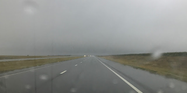
Today was interstate highway 70 day, all the way home. When we left Colby, KS it was 49 degrees with rain and it rained most of the way to Salina. At times the rain was quite heavy and we experienced some hydroplaning a few times, which caused a little puckering of the sphincter. Chris took this iPhone picture out the windshield immediately after a swipe of the windshield wipers. This was pretty much our view all the way to Salina. Along the way the Fusion rolled over 58,000 miles. The average miles per gallon of the Fusion were always above 33 and the best it ever showed was 33.9. We really thought it would pop up to 34 the day before, but it never did. Chris really wanted a baked potato from Wendy's for lunch but no Wendy's appeared on the exit signs around Topeka so we settled for McDonald's at one of the turnpike rest areas. We arrived home at 2:10, where it was 88 degrees. We drove 367 miles today, which made for total trip mileage of 5,131. It was a fantasti...

Pacific Northwest; Day 18

Image
The weather started today like it was most of the day, cloudy with light rain. We departed our motel in Fort Collins, CO at 9:00 and the temperature was 47 degrees. We drove east on Hwy 14. Due to the weather we could not take one last look at the mountains and Chris was a little sad that there would be no more aspens to see this year. 😒 In Ault, CO we saw this scenic byway sign and wondered how in the world a route across eastern Colorado could be scenic. It ended up being a route through grasslands with prong-horned antelope all over the place. Along Hwy 14 we also saw a feedlot for sheep. Neither of us had ever seen that before. At Sterling, CO we turned south on Hwy 61 and we soon came across a field of sunflowers. Where I stopped to take pictures there were these two pretty youngsters standing with a whole field of senior citizens. At Otis, CO we turned eastbound on Hwy 34, but before we did I photographed the city limit sign and the water tower. Otis is one of t...

Pacific Northwest; Day 17

Image
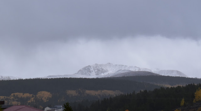
The day did not look promising as we drove away from our motel in Leadville, CO at 8:15 this morning. It was 40 degrees with a drizzling rain and fog. It snowed in the night at higher elevations and we could see snow on mountains where there was none yesterday evening. We drove Hwy 91 north to I-70 and along the way we saw beautiful aspen trees and a pretty reservoir. I-70 took us east to Silverthorne and Hwy 9, which took us north to Kremmling, where we turned eastbound on Hwy 40. The highway pretty much followed the Colorado River and the yellow-gold aspen and narrow leaf cottonwood trees in the river valley were gorgeous. As you can see, we had blue skies by this time. At Granby we turned north on Hwy 34 headed to Rocky Mountain National Park (RMNP). Before arriving, we stopped at the Kawuneeche Visitor Center for a bathroom break and to look around. While there, we found out about Adams Falls, a water fall nearby that we could hike to see. It was back down Hwy 34 at Gra...

Pacific Northwest; Day 16

Image
Today, the first day of autumn, we were looking for the aspen trees at altitude, hoping the leaves were changing to the beautiful yellow-gold color. We left our motel in Grand Junction, CO at 8:30. It was 68 degrees and sunny but clouds were moving in, which provided off-and-on light rain all day. The highest temperature we experienced today was 72 and the lowest was 41, on Grand Mesa at 10:00. Grand Mesa, just east and south of Grand Junction, was our first destination to look for the aspens and we were not disappointed. On the way up Grand Mesa we came across an old ski slope (from 1940) called Mesa Creek Ski Area that had some pretty aspens on the slope. We stopped for a couple photos. After walking about half way up the slope we had a beautiful view of the valley below. On Grand Mesa we made a few other stops for photos. From Grand Mesa we drove down the south side to Hotchkiss and then started northeast to Redstone and Carbondale. After driving over McClure Pass, where...

Pacific Northwest; Day 15

Image
It's a Highway 50 day, all the way from Ely, NV to Grand Junction, CO. We left our motel at 7:20 under cloudy skies with a temperature of 44 degrees. It was a little over 60 miles from Ely to the Utah state line. Along the way we stopped three times for photos. It is a beautiful route in a wide open spaces kind of way. We crossed into Utah and Hwy 50 joined briefly with I-15 and then with I-70 for the rest of the way across Utah into Colorado. We stopped in Delta, UT for a break and scored some cappuccino, guacamole chips and tootsie pops - living high on the hog! A stretch of I-70 across Utah, of over 100 miles, has no services except for rest and view areas. It is a pretty drive. The picture below was taken at the Spotted Wolf view area, which overlooks I-70 as it descends through the San Rafael Reef. In Green River, UT we stopped for lunch at the West Winds Restaurant. We arrived at our destination in Grand Junction, CO at 4:15 after driving 430 miles. The high temperatu...

Pacific Northwest; Day 14

Image
This morning was sunny and 55 degrees. We left our motel in Susanville, CA and went to WalMart, where Chris did a little shopping. When she was checking out the checker asked her if she wanted to purchase a bag for her items. She declined, thinking the offer was to purchase a reusable bag. The checker gave Chris her purchases that she had to carry out without benefit of a plastic bag. Ends up you have to purchase your plastic bag for ten cents if you want your purchases bagged. We were on the road at 8:40 and enjoyed the mostly sunny morning with clouds to make the sky interesting. We stopped in Carson City, NV to see the Nevada State Capital. It was an interesting place and they had their own museum on site. Nevada became the 36th state in 1864 and the flag that flew at the capital from 1864 to 1867 is on display in the museum. Stone used to build the capital was provided by the state's prison quarry. The dome on the capital is made of fiberglass. The iron fence around t...

Pacific Northwest; Day 13

Image
Last night our plan was to go to Crater Lake today. I went to the national parks website for Crater Lake, however, and found out two things. One was they are in a level 1 fire evacuation, which means at any time people living and visiting in the area may be told to evacuate. Two was that the road around the rim is closed during the week for maintenance. So we went to plan B - again. This morning we made motel reservations for the next two nights; Susanville, CA and Ely, NV. We took off from Roseburg, OR shortly after 8:00. It was cloudy and 54 degrees. A short distance down the road it started raining. Poor Chris got more than she bargained for by driving in the rain on I-5 in south Oregon. There are a lot of curves for an interstate highway. She drove about 130 miles, well into California, before I took over and by then the rain had stopped. We stopped at a scenic viewpoint not far into California. I didn't know it at the time but Mt. Shasta was visible (most of it anyway). I ...