Posts

Pacific Northwest; Day 15

Image
It's a Highway 50 day, all the way from Ely, NV to Grand Junction, CO. We left our motel at 7:20 under cloudy skies with a temperature of 44 degrees. It was a little over 60 miles from Ely to the Utah state line. Along the way we stopped three times for photos. It is a beautiful route in a wide open spaces kind of way. We crossed into Utah and Hwy 50 joined briefly with I-15 and then with I-70 for the rest of the way across Utah into Colorado. We stopped in Delta, UT for a break and scored some cappuccino, guacamole chips and tootsie pops - living high on the hog! A stretch of I-70 across Utah, of over 100 miles, has no services except for rest and view areas. It is a pretty drive. The picture below was taken at the Spotted Wolf view area, which overlooks I-70 as it descends through the San Rafael Reef. In Green River, UT we stopped for lunch at the West Winds Restaurant. We arrived at our destination in Grand Junction, CO at 4:15 after driving 430 miles. The high temperatu...

Pacific Northwest; Day 14

Image
This morning was sunny and 55 degrees. We left our motel in Susanville, CA and went to WalMart, where Chris did a little shopping. When she was checking out the checker asked her if she wanted to purchase a bag for her items. She declined, thinking the offer was to purchase a reusable bag. The checker gave Chris her purchases that she had to carry out without benefit of a plastic bag. Ends up you have to purchase your plastic bag for ten cents if you want your purchases bagged. We were on the road at 8:40 and enjoyed the mostly sunny morning with clouds to make the sky interesting. We stopped in Carson City, NV to see the Nevada State Capital. It was an interesting place and they had their own museum on site. Nevada became the 36th state in 1864 and the flag that flew at the capital from 1864 to 1867 is on display in the museum. Stone used to build the capital was provided by the state's prison quarry. The dome on the capital is made of fiberglass. The iron fence around t...

Pacific Northwest; Day 13

Image
Last night our plan was to go to Crater Lake today. I went to the national parks website for Crater Lake, however, and found out two things. One was they are in a level 1 fire evacuation, which means at any time people living and visiting in the area may be told to evacuate. Two was that the road around the rim is closed during the week for maintenance. So we went to plan B - again. This morning we made motel reservations for the next two nights; Susanville, CA and Ely, NV. We took off from Roseburg, OR shortly after 8:00. It was cloudy and 54 degrees. A short distance down the road it started raining. Poor Chris got more than she bargained for by driving in the rain on I-5 in south Oregon. There are a lot of curves for an interstate highway. She drove about 130 miles, well into California, before I took over and by then the rain had stopped. We stopped at a scenic viewpoint not far into California. I didn't know it at the time but Mt. Shasta was visible (most of it anyway). I ...

Pacific Northwest; Day 12

Image
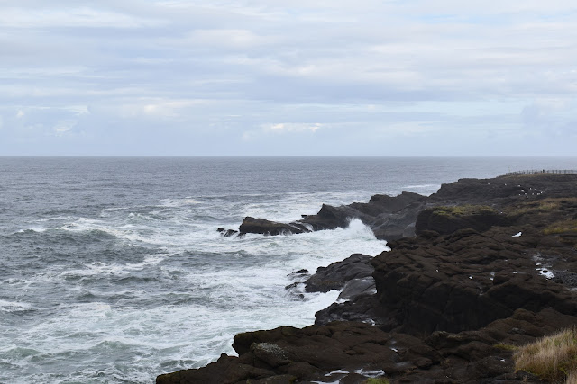
We were expecting rain most of the day today, based on what the weather experts were telling us. The experts missed it today, well, mostly anyway. We had occasional sprinkles or light rain until we were driving away from the coast and it rained fairly hard but only for a few minutes. It was partly sunny and 54 degrees when we left our motel in Lincoln City, OR. Our goal was to drive south along the coast on Hwy 101 and stop to see a few sights. Our first stop was at Boiler Bay and our second was at Depoe Bay. Traveling is relatively slow on Hwy 101, especially when you stop to take photos. We'd been on the road (sort of) for an hour and a half and we'd gone 37 miles! The next stop was at the Yaquina Head Natural Area which had a lighthouse. It was a very pretty area. As we were walking back to our car a cold rain started to fall, which made us hustle our buns. The next stop was my favorite, Heceta Head Lighthouse. Below the lighthouse Cape Creek flows into the P...

Pacific Northwest; Day 11

Image
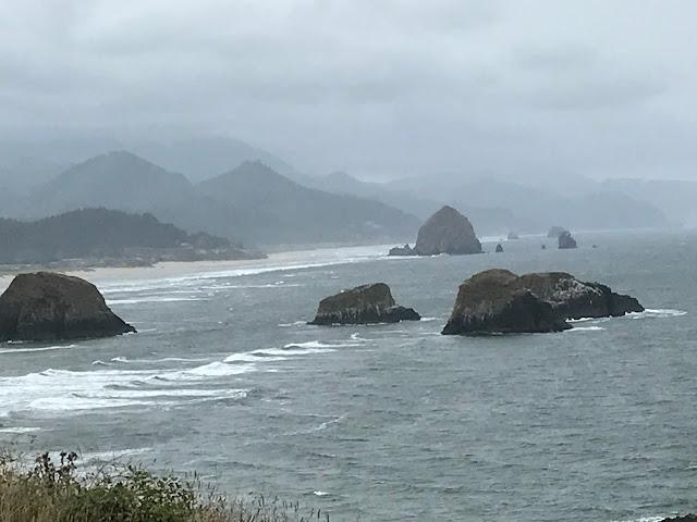
Cloudy and 55 degrees today as we departed our motel in Kelso, WA. We drove west to Astoria, OR and caught Hwy 101 (again) southbound along the Oregon Coast. As we arrived at Ecola State Park near Cannon Beach it started to rain lightly and the wind started to blow - hard. There is a scenic view area that overlooks Cannon Beach and haystack rock. Due to the rain, however, I did not use my nice new Nikon camera. In fact, all but one photo today was taken with my iPhone. Leaving Ecola State Park we drove into Cannon Beach and took off on foot (umbrellas in hand) looking for Haystack Rock. We found it! On the way back to our car Chris did a little shopping and I grabbed a foo-foo coffee, a white chocolate, caramel, English toffee latte. I may need to turn in my man card but it sure tasted good! We drove a short distance south on Hwy 101 where I was able to use my Nikon to shoot a photo of Haystack Rock from a distance. It was barely misting at the time. Further south, on the ...

Pacific Northwest; Day 10

Image
COLD morning! It was cloudy and 48 degrees when we departed Sequim, WA this morning. We actually used our seat heaters when we took off. We drove east and south on Hwy 101 with the intention of visiting Rocky Brook Falls near Brinnon. I followed the directions I had, which matched what my iPhone Google maps was telling me, and there were no falls. If there had been falls they were dried up. Our next stop was at the Washington State Capital in Olympia, WA. The Legislative Building was impressive and, to our surprise, was open on Saturday so we got to look around inside. The "Temple of Justice", which I assumed housed the Washington Supreme Court, was across the courtyard from the Legislative Building. We walked the grounds and took some photos. We came across a very interesting tree, which we later found out was a "monkey puzzle" tree. It was a ranger type lady in the Mt. St. Helens Visitor Center who told us it was a monkey puzzle tree. We wanted to ...

Pacific Northwest; Day 9

Image
The alarm woke us up at 6:00 this morning. We had to leave earlier than usual to drive to Port Angeles to catch the ferry to Victoria, BC (on Vancouver Island) to see the famous Butchart Gardens ( Butchart Gardens ). When we departed the motel in Sequim (pronounced Skwim) at 7:15 it was sunny and 49 degrees. The high today was the mid 70's. The ferry left Port Angeles and crossed the Strait of Juan de Fuca to Victoria, B.C. situated on Vancouver Island. Victoria was a beautiful city near the ferry terminal and we had some time to kill so we walked a bit before hopping on our shuttle bus. The shuttle took us to Butchart Gardens where we walked around and took a boat load of photos. The gardens cover 55 acres of a 130 acre estate originally owned by Robert and Jennie Butchart. In the early 1900's the area was a limestone quarry and Robert mined the limestone to be used in his cement plant. When the limestone was gone Jennie turned it into a garden. Before leaving...